Tisbury Walks - Nadder Valley
![]()
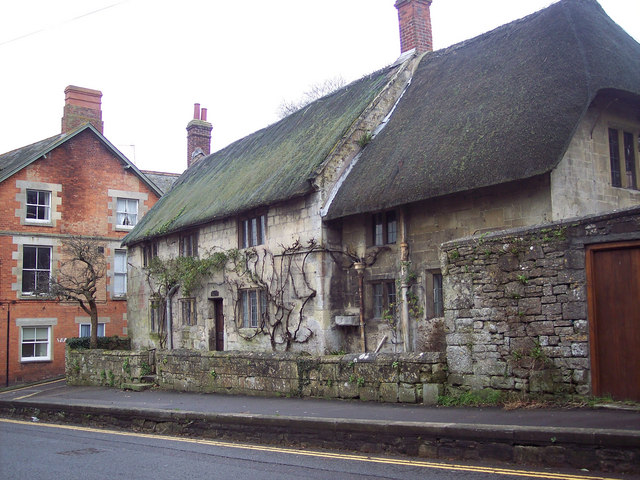
![]() This Wiltshire based village is located in a lovely spot in the valley of the River Nadder. There's also some good trails through the surrounding countryside of the West Wiltshire Downs Area of Outstanding Natural Beauty. The historic village is very pleasant for a stroll with quaint old cottages, a 12th century parish church, an ancient yew and a Grade I listed Tithe Barn to see.
This Wiltshire based village is located in a lovely spot in the valley of the River Nadder. There's also some good trails through the surrounding countryside of the West Wiltshire Downs Area of Outstanding Natural Beauty. The historic village is very pleasant for a stroll with quaint old cottages, a 12th century parish church, an ancient yew and a Grade I listed Tithe Barn to see.
This circular walk around Tisbury takes you to one of the highlights of the area at Old Wardour Castle. You'll also visit the village of Donhead St Andrew and explore the woodland, ponds and parkland of the expansive Wardour Park.
The walk starts in the village car park, next to the River Nadder. You could also start from the train station which is close by. The route then heads south into the countryside around Wallmead Farm, following a bridleway towards the old castle. The 14th century castle is managed by English Heritage who provide an audio tour where you can learn about the castle's history. There are fine views over the surrounding Wiltshire countryside from the top of the castle.
You then head west along the Wessex Ridgeway passing the castle lake and a series of pretty ponds before stopping off at Donhead St Andrew where refreshments are available at the Forester Inn.
The trail then heads north east along the Nadder towards West Hatch before heading east to the site of the mediaval village of Wyck. From here it is a short walk back into Tisbury.
Tisbury Ordnance Survey Map  - view and print off detailed OS map
Tisbury Open Street Map  - view and print off detailed map
Tisbury OS Map  - Mobile GPS OS Map with Location tracking
Tisbury Open Street Map  - Mobile GPS Map with Location tracking
Pubs/Cafes
Head to the excellent Boot Inn for post walk refreshment. The pub dates back to the 17th century and includes a good sized garden area for warmer days. You can find them on the High Street at postcode SP3 6PS for your sat navs.
Dog Walking
The country and woodland trails make for a fine dog walk and the Boot mentioned above is also dog friendly. Please keep your dogs on a lead around the Old Wardour castle.
Further Information and Other Local Ideas
A couple of miles north west of the village there's the expansive Fonthill Estate to explore. There's miles of lovely trails to follow here through woodland and along the large Fonthill Lake.
Just to the north east there's Dinton Park where there's more nice scenery surrounding a Neo-Grecian house.
Just to the south is the pretty village of Compton Abbas where you can visit Fontmell and Melbury Downs, Compton Abbas Airfield and the highest point in the Cranborne Chase AONB at Win Green Hill.
Just east is Broad Chalke where there's a Norman church, pretty watercress beds and views of the River Ebble which meanders through the picturesque village. Just to the west of Broad Chalke is the neighbouring village of Ebbesbourne Wake where you will find two lovely old pubs, a 14th century church and the walk to Prescombe Down.
For more walking ideas in the area see the Cranborne Chase Walks and the Wiltshire Walks pages.
Cycle Routes and Walking Routes Nearby
Photos
The Old Mill. Tisbury Mill was functioning from about 1086 until 1919 and for a further twenty years electricity was generated here.
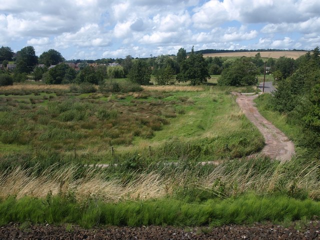
Wyck. A view across the site of the medieval village of Wyck, built on a sloping platform above the Nadder valley in the background, which is crossed by the railway line from Yeovil. In the foreground a track leads to Wick Farm, built on the southeast side of the earthworks; the track just joining it on the extreme left leads to the other side of the same farm.
Nadder valley around Tisbury. A water meadow beside a track running to meet the road arriving at the east end of the village from Ansty. The river runs across the image beside the mature trees in the centre. On the far side the Fonthill stream valley joins the Nadder. Seen from the railway track glimpsed in the foreground.
Church of St John the Baptist, Tisbury. In the churchyard is a 4000 year old yew tree, thought to be the second oldest in Britain.
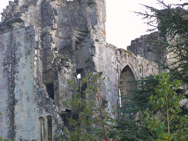
Old Wardour Castle. The ruins of Old Wardour Castle, is situated in a truly romantic and peaceful setting. It was built in 1393 by Lord Lovel and reconstructed in 1578 by Sir Matthew Arundell. It was not built as a fortress but as a tower house with comfort and entertainment in mind, although it did have some defensive provisions.


