Tre'r Ceiri
![]()
![]() This walk climbs to the Iron Age Hillfort of Tre'r Ceiri on the Llyn Peninsula in Wales. It's about a 1.5 mile walk from the conveniently located car park near the village of Llithfaen. In total it's 3 miles there and back with a moderate climb, so a reasonable level of fitness is required.
This walk climbs to the Iron Age Hillfort of Tre'r Ceiri on the Llyn Peninsula in Wales. It's about a 1.5 mile walk from the conveniently located car park near the village of Llithfaen. In total it's 3 miles there and back with a moderate climb, so a reasonable level of fitness is required.
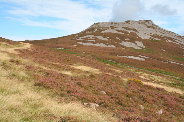
The walk starts from the Yr Eifl car park, just to the west of the hill. From here you can pick up footpaths heading north east up to the hill fort. The fort dates back to the Iron Age and is thought to have been constructed around 200 B.C. It sits at a height of 450 metres (1,480 ft) and is considered one of the finest forts in the UK, with much of the original structure still in place. There are also fabulous views to the surrounding mountains and the coastline with Cardigan Bay clearly visible.
The fort sits on the slopes of Yr Eifl so you could continue your walk by heading west from the fort to climb to the adjacent summit.
Postcode
LL53 6NU - Please note: Postcode may be approximate for some rural locationsTrer Ceiri Ordnance Survey Map  - view and print off detailed OS map
Trer Ceiri Open Street Map  - view and print off detailed map
Trer Ceiri OS Map  - Mobile GPS OS Map with Location tracking
Trer Ceiri Open Street Map  - Mobile GPS Map with Location tracking
Pubs/Cafes
The excellent Caffi Meinir is located a short distance from the car park. The cafe is in a wonderful location, overlooking the beautiful coastline of the area. You can sit outside and enjoy your meal with wonderful views over Porth Y Nant. You can find the cafe at Nant Gwrtheyrn, Llithfaen with a postcode of LL53 6NL for your sat navs. The site also includes a Welsh language school and museum where you can find out about the fascinating history of the area.
Dog Walking
The fort makes for a fine dog walk for fit dogs. The Caffi Meinir mentioned above is dog friendly in the outdoor section where there are plenty of tables.
Further Information and Other Local Ideas
Near Yr Eifl there's the Trefor Quarry to visit. There's some good footpaths around the unusual quarry landscape with more fine coastal views from the elevated position of the site. You can also visit the photogenic rock formations at the Trefor Sea Stacks to see in this area.
To further continue your walking in the area you could pick up the Llyn Coastal Path from near the car park. If you follow it south west it will take you to the lovely beaches at Nefyn and Porthdinllaen.
If you head a few miles to the south you'll come to the southern side of the peninsula where you can visit the coastal settlements of Pwllheli, Llanbedrog and Abersoch.
The Garn Boduan Walk starts from nearby Nefyn. It will take you up to the viewpoint and Iron Age Hill fort located just south of the settlement.
Head inland and there's climb to the remote Garn Fadryn. There's an Iron Age Hillfort and some incredible views from the top of this peaceful hill.
Cycle Routes and Walking Routes Nearby
Photos
Llanaelhaearn: towards Tre'r Ceiri. The fort is probably the best preserved hillfort in Wales and Britain and was occupied during the Roman era. Within its 13 feet high, 15 feet thick walls, 150 huts provided a wild refuge from the pax romana. The Romans had a base at Caernarfon, 15 miles away, but Tre'r Ceir's height and steep approaches and maybe its remoteness meant that it was never slighted by their army. With the departure of the Romans it was abandoned.
Main entrance. This narrow passage through the main rampart was reached via a path uphill from an outer entrance through a second wall; the path running under the rampart. Tre’r Ceiri stands at 485m, one of the highest hillforts in Britain and probably dates from the years immediately preceding the Roman invasion of Wales in AD 78. It appears to have been abandoned after the Romans left Wales.
Taken in the ancient iron age fort on top of the westernmost peak of Yr Eifl, this photo shows the entrance of the fort with the Welsh mountains in the background
Caffi Meinir, the former Capel Seilo and the ruined Ty Hen The cafe, a modern development, is named after Meinir, an 18thC inhabitant who disappeared on the eve of her wedding and whose skeleton was eventually found. The former Calvinist chapel, Capel Seilo, is now the Welsh language centre. In the 19th century, Mass was also celebrated in the valley as many of the quarrymen were Irish immigrants who arrived here by ship. Ty Hen represents the older pre-industrial phase of farming and fishing. The cafe is a fine place to go for refreshments after your walk.


