Ullock Pike
![]()
![]() This circular walk climbs to Ullock Pike for some fine views over Bassenthwaite Lake.
This circular walk climbs to Ullock Pike for some fine views over Bassenthwaite Lake.
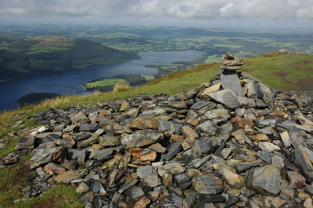
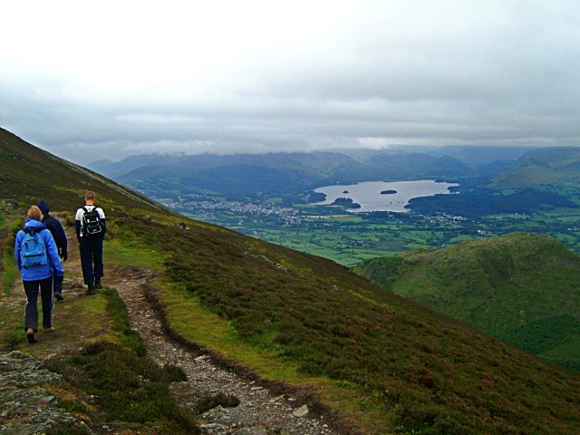
Start the walk from the Dodd Wood car park on the south eastern side of the lake. From here you can pick up woodland trails heading north east towards the Ravenstone Hotel. Here you pick up the Allerdale Ramble and follow the waymarked trail south towards Ullock Pike. At the 690 metre summit you will find a cairn and fine views to Bassenthwaite Lake, Derwent Water and many of the surrounding fells.
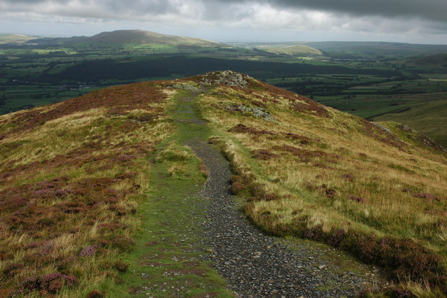
The trail then heads south east along Longside Edge to Carl Side where there is a small tarn. This is a fine ridge walk with excellent views in all directions. At Carl Side the route turns south west to lead you back down to Dodd Wood where a final woodland section takes you back to the car park.
Postcode
CA12 4QD - Please note: Postcode may be approximate for some rural locationsUllock Pike Ordnance Survey Map  - view and print off detailed OS map
Ullock Pike Open Street Map  - view and print off detailed map
Ullock Pike OS Map  - Mobile GPS OS Map with Location tracking
Ullock Pike Open Street Map  - Mobile GPS Map with Location tracking
Pubs/Cafes
Next to Dodd Wood you'll find the very fine Old Sawmill Tearoom. The delightful tearoom was originally a working sawmill until 1970 and it was converted to its present use in 1981. The walls are hung with saws and the original saw blade is still here. You can read about the local history of Dodd Wood and the Mirehouse estate while you enjoy morning coffee, light lunch or afternoon tea. The wood burning stove is stoked up in the colder months, and in summer picnic tables overlook Bassenthwaite Lake. The tea room is wonderfully positioned at the foot of Dodd Fell just to the east of Mirehouse.
Dog Walking
The pike makes for a fine walk with your dog, providing he is in good shape. The woodland trails in Dodd Wood are also very popular with dog walkers. The Old Sawmill tea rooms mentioned above are dog friendly and will provide water bowls.
Further Information and Other Local Ideas
The route passes close to Skiddaw so you can extend the walk by heading off to the north west at Carl Side to climb to the summit.
On the western side of the lake there's the circular walk to Sale Fell to try. The area near the fell also includes the 17th century Pheasant Inn, one of the oldest inns in the Lake District.
For more walking ideas in the National Park see the Lake District Walks page.
Cycle Routes and Walking Routes Nearby
Photos
Summit cairn. View to the north-west from the summit cairn of Ullock Pike. Bassenthwaite Lake can be seen in the valley below, with Sale Fell rising above Wythop Wood on the western slopes of the lake.
At 690 metres above sea level, this is the first peak when climbing Skiddaw by way of Longside Edge from High Side. The lake left of shot is Derwent Water.


