Uttoxeter Walks
![]()
![]() This Staffordshire based market town has some nice river and country trails to try.
This Staffordshire based market town has some nice river and country trails to try.
This walk from the town follows the Staffordshire Way south to the nearby Blithfield Reservoir.
The walk starts from the train station where you can pick up the waymarked trail and follow it south passing the famous Uttoxeter Racecourse which is probably the town's most famous landmark. The trail then takes you into into the countryside towards Scounslow Green and Bagot Forest. You then pass the attractive village of Abbots Bromley before arriving at the reservoir. The large lake is located in the Blithe Valley and has three nice colour coded walking trails to try. It's also a great spot for bird watching with several different species visiting the lake. After enjoying the view across the reservoir the route returns to Uttoxeter on the same paths.
Uttoxeter Ordnance Survey Map  - view and print off detailed OS map
Uttoxeter Open Street Map  - view and print off detailed map
Uttoxeter OS Map  - Mobile GPS OS Map with Location tracking
Uttoxeter Open Street Map  - Mobile GPS Map with Location tracking
Pubs/Cafes
The White Hart Hotel is a good choice for some post walk refreshments. The Grade II listed pub dates back to the 1550s and has an interesting history. During the military campaigns of 1745, whilst attempting to restore the Stuart kings to the thrones of Scotland and England, the Jacobites used ‘The White Hart Hotel’ as the Derby headquarters of ‘Bonnie Prince Charlie and their leader Sir William Bagot. It’s alleged Bagot was arrested here after enjoying an ‘excellent dinner’. The pub does very good food and also provides quality accommodation if you need to stay over. You can find the pub on Carter Street with a postcode of ST14 8EU for your sat navs.
Dog Walking
The country trails make for a nice dog walk and the White Hart Hotel mentioned above is also dog friendly in the bar area.
Further Information and Other Local Ideas
On the northern side of the town you can pick up riverside paths along the River Tean or along the River Dove. Heading east will take you to the village of Doveridge where there's a number of interesting bridges over the River Dove.
The town is located close to the Churnet Valley where there are some lovely walks to try.
A few miles north you can pick up the Denstone Railway Walk. This uses part of a railway path and the Staffordshire Way to create a circular walk around the village. It also visit the lovely Dimmingsdale where there are miles of woodland trails and a series of pretty ponds to see. The Rocester Roman Fort can also be reached on foot by following the Staffordshire Way north for a few miles. This would also take you to the worthy village of Ellastone. Here you'll find a 16th century church, the site of a 12th century ruined abbey, a fine old inn dating from the 1850s and nice trails along the River Dove.
The town was once the terminus of a branch of the Caldon Canal but most signs of this, apart from an area of Uttoxeter called "The Wharf", have disappeared.
About three miles north west of the town you will find the remains of the 12th century Croxden Abbey. There are nice trails to follow around the substantial abbey ruins with information boards detailing the history of the site. It's an interesting area and run by English Heritage with no charge for your visit.
For more walking ideas in the area see the Staffordshire Walks page.
Cycle Routes and Walking Routes Nearby
Photos
Tumulus, Toothill Lane, Highwood near Uttoxeter. The name Toothill is widely held to indicate an ancient surveying landmark. This location above the Dove Valley would certainly fit the bill. The presence of a stand of mature trees could also suggest a site that retains a level of veneration instead of being given over to normal agriculture.
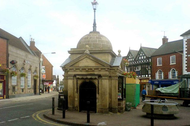
The Butter Cross, Abbots Bromley. This unusual feature is in the village which hosts the famous Horn Dance. The nearby church is well worth a visit.


