Weavers Way Circular Walk
![]()
![]() This route uses part of the Weavers Way and other paths along the River Bure to create a circular route around Acle in the Norfolk Broads. The route runs for about 20 miles on a series of flat footpaths with fine views across the marshes.
This route uses part of the Weavers Way and other paths along the River Bure to create a circular route around Acle in the Norfolk Broads. The route runs for about 20 miles on a series of flat footpaths with fine views across the marshes.
The walk starts in the market town of Acle where you can pick up the waymarked Weavers Way and follow it south to Tunstall and Halvergate. The trail then heads east to meet with the River Yare and Breydon Water. There's a lovely waterside path here with fine views across the water which is also and excellent place for birdwatching.
The trails lead towards Great Yarmouth where you pick up the riverside paths along the River Bure. Follow the paths west and they will take you past Ashtree Farm, Mautby Marsh Mill, Runham Mill, Stracey Arms Mill and the village of Stokesby before returning to Acle.
Weavers Way Circular Walk Ordnance Survey Map  - view and print off detailed OS map
Weavers Way Circular Walk Open Street Map  - view and print off detailed map
Weavers Way Circular Walk OS Map  - Mobile GPS OS Map with Location tracking
Weavers Way Circular Walk Open Street Map  - Mobile GPS Map with Location tracking
Cycle Routes and Walking Routes Nearby
Photos
The church of St Peter & St Paul in Tunstall - the ruined tower. In Roman times the River Bure flowed into a large estuary extending from Acle to present-day Great Yarmouth; Faden's 1797 map of Norfolk shows the then coastal villages of Tunstall, Halvergate and Wickhampton on a spur of higher ground that was surrounded by Moulton Bog (west), Acle Wet Common (north) and the Halvergate Marshes (east). According to old records the church had fallen into disrepair by 1704; the chancel arch was bricked up in 1705 and a plaque above the doorway into the chancel informs that it was rebuilt by Mrs Elizabeth Jenkinson. More repairs were carried out in 1853. In 1980 the church was declared redundant and a Trust was formed to help repair and maintain what remains of the church: the chancel is still intact and visitors are welcome
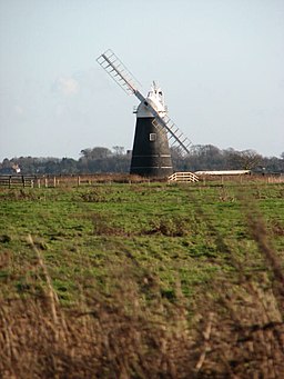
View across the Halvergate marshes. The view is towards the southeast and Mutton's drainage mill, a tower mill located on Fleet Dike, that has been restored during the 1970s.


