Welney Wetlands Centre
![]()
![]() Enjoy waterside footpaths along the New Bedford River on this easy circular walk at the Welney Wetland Centre.
Enjoy waterside footpaths along the New Bedford River on this easy circular walk at the Welney Wetland Centre.
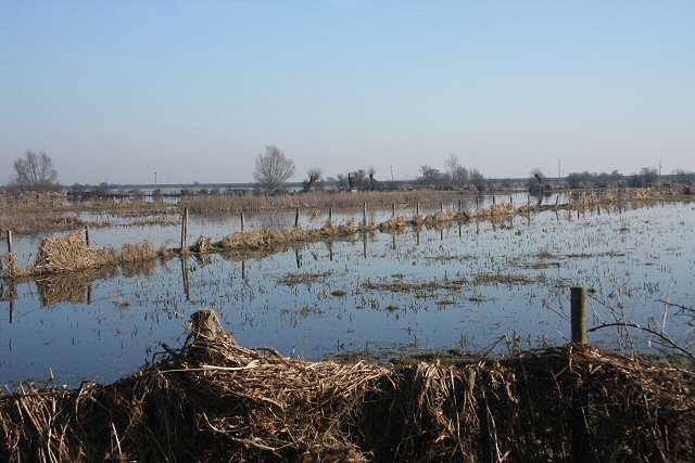
It's a unique place with freshwater grazing marshland and a huge variety of birdlife to look out for. The area is known as the Ouse Washes covering the area between two diversion channels of the River Great Ouse: the Old Bedford River and the New Bedford River. There's nice grassy paths and boardwalks making it a great place for walkers as well as wildlife enthusiasts.
You can start your walk from the car park and visitor centre on Station Road. Then pick up the trails heading west along the New Bedford River. The walk then crosses the bridge to the village of Welney and picks up the trail along the Old Bedford River. You cross again before returning to the car park.
The area is fantastic for bird watching so be sure to bring your binoculars. Birds you may see include Grey heron, Little egret, Black-tailed godwit, Lapwing, Avocet, Oystercatcher, Coot and Moorhen.
The Hereward Way long distance trail crosses the reserve so you can pick up the trail to extend your walk. Heading south west will take you along the river towards Little Downham. Heading north west takes you towards March.
Heading north east along the river will take you towards Downham Market where you can pick up the Fen Rivers Way and enjoy a walk along the River Great Ouse.
Postcode
PE14 9TN - Please note: Postcode may be approximate for some rural locationsPlease click here for more information
Welney WWT Ordnance Survey Map  - view and print off detailed OS map
Welney WWT Open Street Map  - view and print off detailed map
Welney WWT OS Map  - Mobile GPS OS Map with Location tracking
Welney WWT Open Street Map  - Mobile GPS Map with Location tracking
Cycle Routes and Walking Routes Nearby
Photos
Ouse Washes at Welney. The A1101 is often closed during the winter between the village and Suspension Bridge. The road often floods to a depth of five or six feet, as can be seen by the detritus left on fences.


