Weston Woods
![]()
![]() These pretty woods in Weston-Super-Mare have a series of good footpaths to try. The woods are also a local nature reserve covering 130 hectares (321 acres) on Worlebury Hill above the town. From the elevated position of the woods there are nice views over Sand Bay towards Wales. There's also an Iron Age hillfort at the western tip of the site where the defensive ramparts can be clearly seen.
These pretty woods in Weston-Super-Mare have a series of good footpaths to try. The woods are also a local nature reserve covering 130 hectares (321 acres) on Worlebury Hill above the town. From the elevated position of the woods there are nice views over Sand Bay towards Wales. There's also an Iron Age hillfort at the western tip of the site where the defensive ramparts can be clearly seen.
You can park at the car park on Worlebury Hill Road at the eastern tip of the woods. Then pick up the trails heading west towards the coast.
To extend your walking in the area you could pick up the West Mendip Way long distance path and explore the Mendip Hills from Weston-Super-Mare.
Just to the north of the woods you will find the splendid Sand Point where you can enjoy fine views across the Bristol Channel on a beautiful coastal peninsula.
Just to the south you can enjoy more great coastal views on Brean Down or climb to the nearby Bleadon Hill.
Postcode
BS22 9ST - Please note: Postcode may be approximate for some rural locationsWeston Woods Ordnance Survey Map  - view and print off detailed OS map
Weston Woods Open Street Map  - view and print off detailed map
Weston Woods OS Map  - Mobile GPS OS Map with Location tracking
Weston Woods Open Street Map  - Mobile GPS Map with Location tracking
Pubs/Cafes
On the western side of the woods you'll find the excellent Captains Cabin Bar & Restaurant. It's in a fine location, right on the coast near the old Birnbeck Pier. There's a lovely terrace area where you can enjoy a drink with sea views. They also do a fine Sunday roast if you are feeling peckish. You can find them on 51 Birnbeck Road with a postcode of BS23 2EF for your sat navs.
Dog Walking
The woodland trails are ideal for dog walking so you'll probably bump into other owners on a fine day. The nearby Sand Bay and Sand Point are also popular places to take your dog.
Further Information and Other Local Ideas
The Weston-Super-Mare Walk starts at the Grand Pier from the town. It visits the old Birnbeck Pier and Sand Point before heading to the woods. It's a nice way of visiting the woods and some of the other local highlights.
For more walking ideas in the area see the Somerset Walks and the Mendip Hills Walks page.
Cycle Routes and Walking Routes Nearby
Photos
Footpath to Kewstoke. One of many paths through Weston Woods. This one slants diagonally down from Worlebury Hill to join Kewstoke Road.
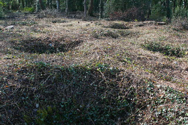
Weston-super-Mare: Worlebury hillfort. Recent tree clearance of part of the 10-acre site, in the hands of North Somerset Council, has revealed some of the 93 storage pits first discovered in the 1850s, when the site was excavated by a group of antiquarians. Grain was found in a number of the pits, which are unusually large at 6 to 8 feet in diameter and typically 6 feet deep. For a good guide to the hillfort, see ‘Worlebury. The story of the Iron Age hill-fort at Weston-super-Mare’, obtainable from Woodspring Museum, Burlington Street, Weston-super-Mare BS23 1PR.
Birnbeck Pier as seen from the west of Weston Woods. The pier is notable as the only pier in the country which links the mainland to an island. The Grade II listed pier dates from 1867 and is located just north of the town. The pier has been closed to the public since 1994 and is now on the Buildings at Risk Register. Sadly it remains in a largely derelict state.


