Whichford Wood
![]()
![]() Enjoy a short, peaceful stroll through these delightful woods on the edge of the Cotswolds. The area consists of Broadleaved and conifer woodland with a number of woodland walking trails to try. There are lovely views over the surrounding Warwickshire countryside from the forest too. Look out for various wildflowers, bluebells and wildlife including fallow deer. After your walk you can enjoy refreshments at the pub in the village of Whichford.
Enjoy a short, peaceful stroll through these delightful woods on the edge of the Cotswolds. The area consists of Broadleaved and conifer woodland with a number of woodland walking trails to try. There are lovely views over the surrounding Warwickshire countryside from the forest too. Look out for various wildflowers, bluebells and wildlife including fallow deer. After your walk you can enjoy refreshments at the pub in the village of Whichford.
The Macmillan Way long distance footpath runs through the woods so you could pick this up to extend your walk through Long Compton Woods to the village of Long Compton. If you continue south you will soon come to the fascinating Rollright Stones.
The group of Neolithic and Bronze Age megalithic monuments consists of three groups of stones: the King's Men stone circle, the Whispering Knights burial chamber and the single King Stone.
Postcode
CV36 5JP - Please note: Postcode may be approximate for some rural locationsWhichford Wood Ordnance Survey Map  - view and print off detailed OS map
Whichford Wood Open Street Map  - view and print off detailed map
Whichford Wood OS Map  - Mobile GPS OS Map with Location tracking
Whichford Wood Open Street Map  - Mobile GPS Map with Location tracking
Further Information and Other Local Ideas
The circular Hook Norton Walk visits the woods from the nearby village. It also visits Ascott, the Rollright Stones and the village of Great Rollright. It's a nice way of exploring the countryside surrounding the wood.
A few miles to the north is the worthy village of Tysoe where you could enjoy a climb to the Tysoe Windmill. The photogenic old mill sits on top of a 184 metre hill with excellent views over the Cotswolds.
For more walking ideas in the area see the Warwickshire Walks and Cotswolds Walks pages.
Cycle Routes and Walking Routes Nearby
Photos
Bluebells in Whichford Wood. At their peak, 28th April 2007. Whichford Wood has hundreds of bluebell spots like this and many paths to see them from, so is very popular with walkers.
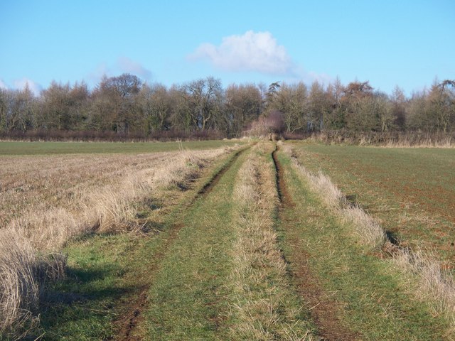
The bridleway from Great Rollright, having ascended from the valley bottom, levels out as it approaches the wood.
Along the top of the woods. A good bridleway skirts the southern edge of Whichford Wood, providing excellent walking and riding. This is part of the Macmillan Way long distance path.


