Whitbarrow National Nature Reserve
![]()
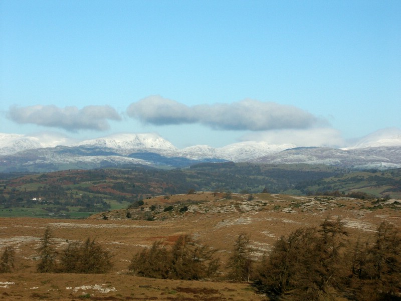
![]() Enjoy wonderful limestone scenery, ancient woodland and rich ground flora in this nature reserve near Witherslack in the Lake District National Park. The walk starts at Mill Side and heads to Whitbarrow Scar on footpaths and quiet country lanes. You then climb to the high point known as the Lord's seat where you will find a large obelisk shaped cairn. From here there are marvellous panoramic views of the River Kent Estuary and Morecambe Bay. The return leg is a gentle descent along woodland paths passing Wakebarrow, Rough Hill Wood, Windy Howe and Watson's Wood before returning to Mill Side.
Enjoy wonderful limestone scenery, ancient woodland and rich ground flora in this nature reserve near Witherslack in the Lake District National Park. The walk starts at Mill Side and heads to Whitbarrow Scar on footpaths and quiet country lanes. You then climb to the high point known as the Lord's seat where you will find a large obelisk shaped cairn. From here there are marvellous panoramic views of the River Kent Estuary and Morecambe Bay. The return leg is a gentle descent along woodland paths passing Wakebarrow, Rough Hill Wood, Windy Howe and Watson's Wood before returning to Mill Side.
Features in the reserve include a small traditional orchard with Westmorland damson and apple trees and pretty bluebell woodland. Wildlife lovers should look out for roe and red deer at Howe Ridding Wood. Birdlife includes buzzard, raven, sparrowhawk, woodcock, great spotted woodpecker, redstart and nuthatch.
Alfred Wainwright praises Whitbarrow in his book 'The Outlying Fells of Lakeland' describing it as 'the most beautiful [walk] in this book, beautiful it is every step of the way. ... All is fair to the eye on Whitbarrow.'
Whitbarrow can be easily reached from Kendal which is about 5 miles to the north east. Here you can extend your walking by trying our Kendal Castle and River Walk. The climb to Cartmel Fell is located just to the west of the reserve where there are more fine views over the Lyth Valley.
Whitbarrow National Nature Reserve Ordnance Survey Map  - view and print off detailed OS map
Whitbarrow National Nature Reserve Open Street Map  - view and print off detailed map
Whitbarrow National Nature Reserve OS Map  - Mobile GPS OS Map with Location tracking
Whitbarrow National Nature Reserve Open Street Map  - Mobile GPS Map with Location tracking
Further Information and Other Local Ideas
The circular Witherslack Walk starts from the nearby village and visits Yewbarrow before climbing to the reserve. The village includes a fine local pub where you could enjoy some post walk refreshment.
To the south you can enjoy a climb to Hampsfell Hospice, a limestone tower built in 1846 by the vicar of Cartmel.
Just to the east of Witherslack there's the Foulshaw Moss Nature Reserve. The reserve has some nice boardwalks to follow over the peat bog. It's also excellent for wildlife with ospreys, hobby, sparrowhawk, buzzard and peregrine to look out for from the bird hides.
Cycle Routes and Walking Routes Nearby
Photos
On Whitbarrow Birch woodland and limestone on Whitbarrow. The muddy path is made by cattle which were surprisingly encountered in the scrubby woodland.
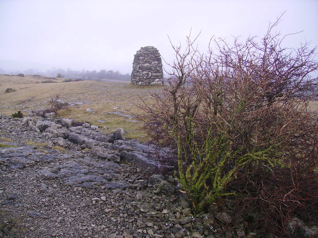
Cairn, Whitbarrow. The Cairn is a memorial to Canon G.A.K. Hervey who founded the Lake District Naturalist's Trust. The area is now a National Nature Reserve covering over 500 acres, one of the largest in the country.


