White Horse Trail
![]()
![]() This is a circular long distance, waymarked trail running through Wiltshire. It starts at the Westbury White Horse and runs through Pewsey, Marlborough, Broad Town, Cherhill, Devizes, Steeple Ashton and Bratton. The walk runs through some beautiful Wiltshire countryside and also visits fascinating historical sites such as the Avebury Stones and Silbury Hill. Other highlights include the Lansdowne Monument at the Cherhill White Horse near the watershed of the River Avon and the River Thames. Near here you'll also pass Hackpen Hill and it's associated white horse. Also known as the Broad Hinton White Horse it was created in 1838 to commemorate the coronation of Queen Victoria.
This is a circular long distance, waymarked trail running through Wiltshire. It starts at the Westbury White Horse and runs through Pewsey, Marlborough, Broad Town, Cherhill, Devizes, Steeple Ashton and Bratton. The walk runs through some beautiful Wiltshire countryside and also visits fascinating historical sites such as the Avebury Stones and Silbury Hill. Other highlights include the Lansdowne Monument at the Cherhill White Horse near the watershed of the River Avon and the River Thames. Near here you'll also pass Hackpen Hill and it's associated white horse. Also known as the Broad Hinton White Horse it was created in 1838 to commemorate the coronation of Queen Victoria.
There's also a long waterside section along the Kennet and Avon Canal through Devizes and wonderful views across the Vale of Pewsey around Pewsey.
White Horse Trail Ordnance Survey Map  - view and print off detailed OS map
White Horse Trail Open Street Map  - view and print off detailed map
*New* - Walks and Cycle Routes Near Me Map - Waymarked Routes and Mountain Bike Trails>>
White Horse Trail OS Map  - Mobile GPS OS Map with Location tracking
White Horse Trail Open Street Map  - Mobile GPS Map with Location tracking
Pubs/Cafes
The Hourglass is in a lovely location right next to the canal in Devizes and makes a great stopping point on the route. From the terrace garden there are lovely views over the water to the surrounding countryside. It's a great place to relax and watch the boats go by on warm summer days. They have an excellent menu and can be found at Horton Avenue with a postcode of SN10 2RH.
Also on the canal in Pewsey is The Waterfront Bar And Bistro at Pewsey Wharf. On finer days you can sit outside in the lovely garden area and enjoy views of the canal with your meal. You can find them at postcode SN9 5NU for your sat navs.
In the village of Cherhill, near the Cherhill White Horse, you will find the Black Horse. The pub has an interesting history dating back to the 18th century when it was a coaching inn. It is notable for being the hideout for the infamous Cherhill Gang, a group of highwaymen that would rob passers by naked to avoid being caught. They have a charming interior with interesting artwork on the walls. There's also a good menu and an outdoor area as well. You can find them at a postcode of SN11 8UT for your sat navs. The village itself is also worth exploring with a number of picturesque thatched cottages and an old church to see.
The little village of Broad Hinton is located just off the trail near the Hackpen White Horse. Here you can visit The Crown pub. They do excellent food and also have a lovely large garden area with fabulous views. Inside is very attractive too with a cosy fire for the winter. You can find them at a postcode of SN4 9PA.
Further Information and Other Local Ideas
For more walking ideas in the area see the Wiltshire Walks page.
Cycle Routes and Walking Routes Nearby
Photos
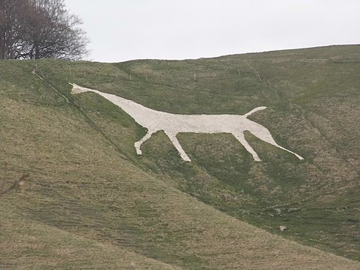
View of the Westbury White Horse at the start of the walk. Construction lines of the concrete surface now visible; an illusion shattered! The earthwork ditch around the top is part of Bratton Camp, an Iron Age fort and National Monument.
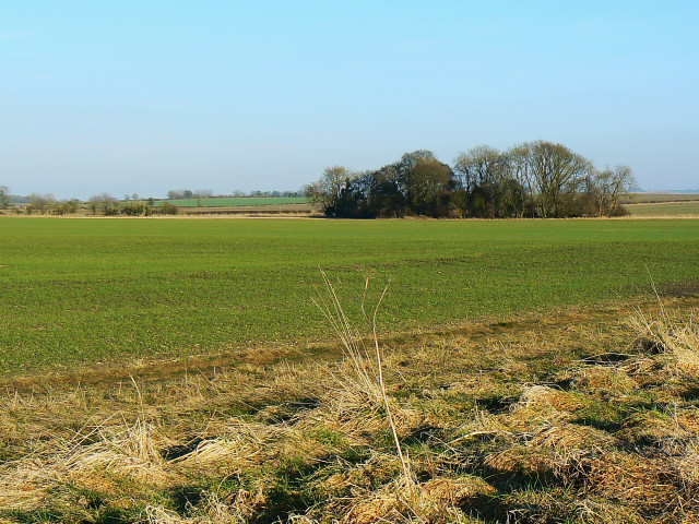
Near Broad Hinton. The long distance path doubles as a farm track along this stretch. In the far distance is west Swindon. The windmill at the right is at square SU1065983468, approximately.


