Winchcombe to Cleeve Hill Walk
![]()
![]() This circular walk takes you to from Winchcombe to Cleeve Hill, the highest point in the Cotswolds Hills. The route uses a section of the Cotswold Way National Trail to take you up to the hill before following other public footpaths back to the town. The route runs for a distance of about 10 miles with a fairly challenging hill climb on the way. You'll also pass the noteworthy ancient long barrow of Belas Knap and enjoy views of the River Isbourne on the way.
This circular walk takes you to from Winchcombe to Cleeve Hill, the highest point in the Cotswolds Hills. The route uses a section of the Cotswold Way National Trail to take you up to the hill before following other public footpaths back to the town. The route runs for a distance of about 10 miles with a fairly challenging hill climb on the way. You'll also pass the noteworthy ancient long barrow of Belas Knap and enjoy views of the River Isbourne on the way.
The walk starts from the southern side of the town, near to the tourist information centre and Almsbury Farm. From here you can pick up the Cotswold Way and follow it south to Wadfield Farm and Belas Knap. The fascinating scheduled ancient monument dates from around 3000 BC and includes a false entrance and independently accessible side chambers.
From the long barrow you head west to Wotfield Farm before coming to Cleeve Hill.
The summit stands at a height of 1,083 feet (330 m) commanding fine views over Cheltenham racecourse, the River Severn, the Cotswolds Hills and back to the town of Winchcombe.
The route then turns north west, skirting the edge of Nutterswood and Thrift Wood before coming to Woodmancote. The trail then heads east past the golf course towards old Postlip Hall where you pick up the Isbourne Way. This trail takes you along the River Isbourne back to Winchcombe where the route finishes.
Winchcombe to Cleeve Hill Walk Ordnance Survey Map  - view and print off detailed OS map
Winchcombe to Cleeve Hill Walk Open Street Map  - view and print off detailed map
Winchcombe to Cleeve Hill Walk OS Map  - Mobile GPS OS Map with Location tracking
Winchcombe to Cleeve Hill Walk Open Street Map  - Mobile GPS Map with Location tracking
Pubs/Cafes
The Corner Cupboard Inn is a historic pub dating all the way back to the 15th century. The interior is full of character with flag stone floors, oak paneling, Cotswold stone walls, roaring fires and oak beams. If the weather is fine you can relax in the quintessentially English garden where there is often a BBQ in the summer months. You can find the pub on Gloucester Street at a postcode of GL54 5LX for your sat navs. The pub is also dog friendly if you have your four legged friend with you.
Cycle Routes and Walking Routes Nearby
Photos
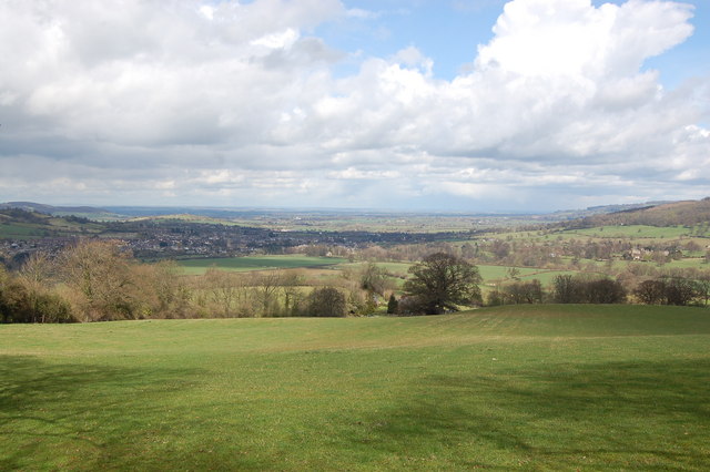
Pastureland near Wadfield Farm, south of Winchcombe. View looks northwards across sheep pasture towards the vale of Evesham. The town of Winchcombe can be seen on the left with tower of St Peter's church standing prominent. To the right is Sudeley castle.
Belas Knap Long Barrow, Ancient Monument. Belas Knap is one of the finest neolithic long barrows in Gloucestershire. Like all the other seventy or so known long barrows in the county, it is located on the limestone uplands of the Cotswolds. The long distance footpath The Cotswold Way passes this feature.
Cleeve Cloud Trig Point. The Trig Pillar is actually on the lower "summit" of Cleeve Cloud and is only the third highest point on Cleeve Hill at 317 metres, but has by far the best views. The Severn Vale and Malvern Hills are in the background. The pedestal behind the pillar describes several of the landmarks visible.


