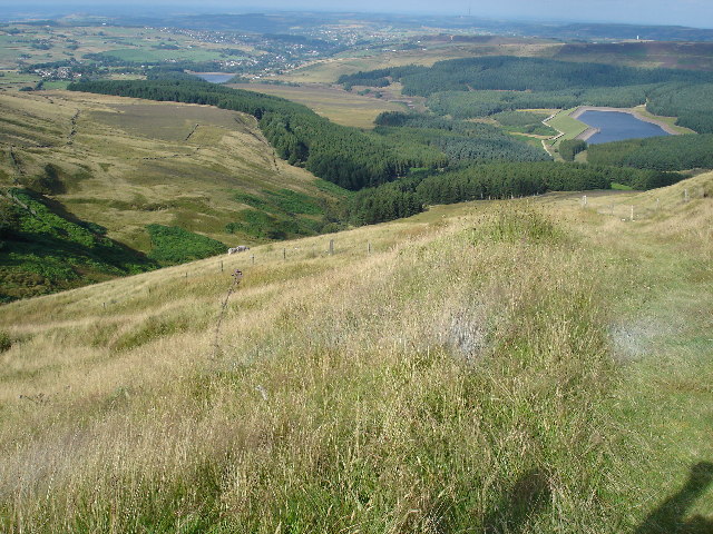
Yateholme Reservoir
![]()
![]() This walk visits Yateholme Reservoir in Holmfirth. You can follow trails around the small reservoir and enjoy some fine views over the surrounding moors.
This walk visits Yateholme Reservoir in Holmfirth. You can follow trails around the small reservoir and enjoy some fine views over the surrounding moors.
The trail runs for about a mile with some pleasant woodland encircling the site.
Ramsden Reservoir and Riding Wood Reservoir are very close by so it's easy to extend your walking around these two other bodies of water.
The transmitter and viewpoint at Holme Moss lies just to the west.
Postcode
HD9 2QH - Please note: Postcode may be approximate for some rural locationsYateholme Reservoir Ordnance Survey Map  - view and print off detailed OS map
Yateholme Reservoir Open Street Map  - view and print off detailed map
Yateholme Reservoir OS Map  - Mobile GPS OS Map with Location tracking
Yateholme Reservoir Open Street Map  - Mobile GPS Map with Location tracking
Cycle Routes and Walking Routes Nearby
Photos
Yateholme Reservoir. The reservoir was constructed in the 1870s following the submission of the Batley Corporation Water Bill to Parliament in 1871 which initially proposed to build five reservoirs in the area.
Netherley Clough. This stream runs just to the north of the reservoir. It is formed by the confluence of Holme Woods Dike and Gusset Dike at Kiln Bent Bridge. It then flows north-easterly to Ramsden Reservoir. Its tributaries include the Yateholme Reservoir spillway and Great Bent Dike. At the north eastern end of the reservoir there's a footpath heading north to the stream and bridge.


