Banstead Downs
![]()
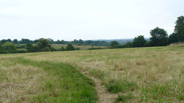
![]() This walk crosses Banstead Downs Site of Special Scientific Interest in Surrey. The downs are very pretty in the summer with the open grass chalkland covered in a variety of wildflowers. You'll pass Gally Hills and through some attractive woodland as you make your way along the path. From the high points there are great views towards the city of London.
This walk crosses Banstead Downs Site of Special Scientific Interest in Surrey. The downs are very pretty in the summer with the open grass chalkland covered in a variety of wildflowers. You'll pass Gally Hills and through some attractive woodland as you make your way along the path. From the high points there are great views towards the city of London.
The downs support a huge variety of interesting plants and flowers. Look out for common spotted orchid, early purple orchids, vetch, horse-shoe vetch, ox-eye daisy and purging flax. Wildlife includes roe deer, fox, rabbit and stoat. Notable bird sightings include Kestrels, Buzzards and Sparrowhalk. In the summer months you can see lots of butterflies around the wildflowers. Keep your eyes peeled for Common Blue, Chalkhill Blue and Marbled White.
You can start your walk from Banstead rail station which is right next to the downs. From here pick up the London Loop footpath to take you across the site.
To extend your walking in the area you could follow the London Loop north to Nonsuch Park. It's a lovely park with wide lawns, pretty gardens, woodland and the impressive Nonsuch Mansion. If you head east you'll soon come to Oaks Park in Carshalton. It's a pretty little park with a nice cycling and walking trail.
Just to the south of Banstead you'll find Banstead Woods. The lovely bluebell woods have a nice nature trail to try.
Postcode
SM2 5PQ - Please note: Postcode may be approximate for some rural locationsBanstead Downs Ordnance Survey Map  - view and print off detailed OS map
Banstead Downs Open Street Map  - view and print off detailed map
Banstead Downs OS Map  - Mobile GPS OS Map with Location tracking
Banstead Downs Open Street Map  - Mobile GPS Map with Location tracking
Pubs/Cafes
Head south into Banstead and there's The Woolpack for some post walk refreshments. The 18th century pub serves good food and real ales from Shepherd Neame, Britain's oldest brewer. They also have a nice patio garden to sit out in if the weather is good. You can find them at 186 High Street, SM7 2NZ. They are dog friendly.
Further Information and Other Local Ideas
Just to the south there's Tadworth and Banstead Heath where there's miles of good walking and cycling trails to try. The heath also includes a fine 16th century pub which is worthy of investigation.
For more walking ideas in the area see the Surrey Walks page.
Cycle Routes and Walking Routes Nearby
Photos
Memorial on Banstead Downs golf course (Surrey, UK) where an American pilot was killed in 1944 after steering his plane away from houses. The inscription reads: In memory of 2nd Lieutenant Andrew Leslie Jackson DFC US Army Air Corps serving with the 33rd Photo Reconnaissance Squadron Chalgrove, Oxfordshire. Died on 31st May 1944 at 14.45 hours when the Lockheed F-5 B # 105 Lightning aircraft he was piloting in the line of duty crashed near this, the 18th tee of the Banstead Downs Golf Club. The memorial was dedicated in 1999.
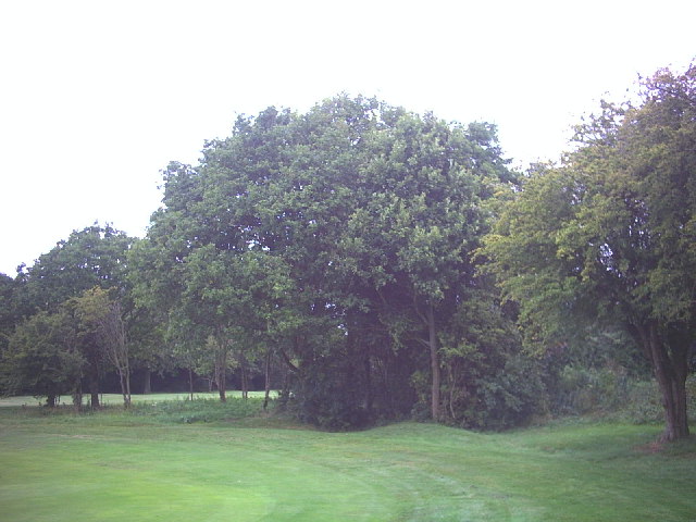
One of four tumuli called Gally Hills, on Banstead Downs golf course (Surrey, UK). Excavations of this hlaew in 1972 found the burial of a Saxon warrior as well as skeletons from a later gallows. It is a scheduled ancient monument. The view is looking east from the fairway and just beyond the tree is the A217.


