Harewood Forest
![]()
![]() This large forest near Andover has miles of woodland walking trails to try. You can reach the forest by following the Test Way from nearby Chilbolton or Wherwell. It's about a one mile walk through the countryside to the woods from Wherwell. The Test Way passes through the woods but there are also other public footpaths to pick up once you are there.
This large forest near Andover has miles of woodland walking trails to try. You can reach the forest by following the Test Way from nearby Chilbolton or Wherwell. It's about a one mile walk through the countryside to the woods from Wherwell. The Test Way passes through the woods but there are also other public footpaths to pick up once you are there.
The forest has an intersting history with the 19th century Dead Man's Plack to see. The Grade-II listed monument is dedicated to Ethelwald, Ealdorman of East Anglia, who (as legend goes) was killed in 963 by his rival in love, King Edgar I.
To extend your walking in the area you could head south west along the Test Way towards Stockbridge and visit Danebury Hill Fort. The fascinating Iron Age fort commands wonderful views over the Test Valley.
Cyclists can reach the forest area by cycling along National Cycle Route 246 which runs through nearby Goodworth Clatford and Upper Clatford from Andover.
The woods are located just to the east of the town of Andover. There's nice trails to follow along the River Anton and around Anton Lakes Nature Reserve here.
Postcode
SP11 7TB - Please note: Postcode may be approximate for some rural locationsHarewood Forest Ordnance Survey Map  - view and print off detailed OS map
Harewood Forest Open Street Map  - view and print off detailed map
Harewood Forest OS Map  - Mobile GPS OS Map with Location tracking
Harewood Forest Open Street Map  - Mobile GPS Map with Location tracking
Pubs/Cafes
In nearby Longparish there's the The Cricketers for post walk refreshment. The attractive former coaching inn is in a nice location close to the river. They serve good quality, homemade food which you can enjoy in the lovely garden area. You can find them at postcode SP11 6PZ for your sat navs.
Dog Walking
As you'd expect, the expansive forest with its wide trails are ideal for dog walking so you'll probably meet other owners on your visit. The Cricketers pub mentioned above is also dog friendly.
Further Information and Other Local Ideas
The Longparish Walk visits the woods from the nearby village. There's picturesque thatched cottages, old mills, weirs, pretty lakes and a fine old pub to visit here.
Just outside Andover there's the noteworthy small town of Whitchurch to explore. The town has a lovely mill trail visiting the historic Silk Mill and other old buildings along the River Test. Near here there's also St Mary Bourne with its rows of picturesque thatched cottages and views of the pretty Bourne Rivulet, a tributary of the River Test.
For more walking ideas in the area see the Hampshire Walks page.
Cycle Routes and Walking Routes Nearby
Photos
Longparish village sign on The Middleway, Harewood Forest. This village sign is alongside the Middleway, after a bend and before it descends to Middleton in the Test Valley below.
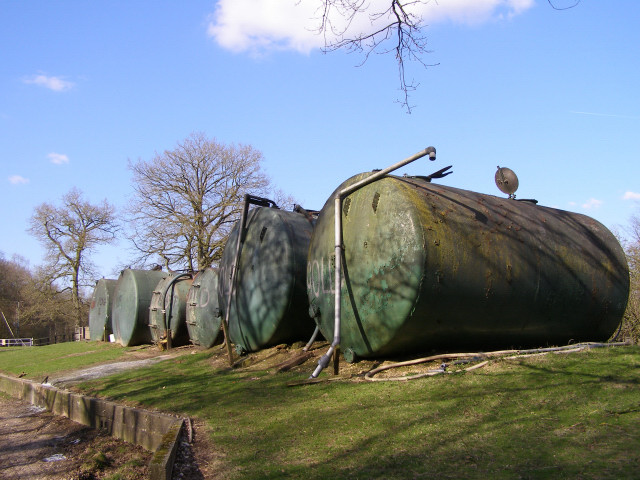
Storage tanks at Pachington Piggery. The piggery at Pachington is hidden amongst the trees of Harewood Forest, west of the old Longparish Station. These storage tanks are on a bank next to one of the concrete tracks that were laid in the Second World War when the forest was used to store munitions. The Test Way footpath follows this route through the south of the forest.
Course of the Roman road through the forest. Looking southeast along the footpath that follows the course of the Roman road through what is now Harewood Forest. The road originally led to Venta Belgarum, nowadays known as Winchester. Today the forest is a Hampshire County Council Countryside Heritage Area criss-crossed with public rights of way; it is also a working forest and used for game shooting.
Burnt Lodge Copse. Burnt Lodge Copse is on the edge of the forest, alongside the A303 dual carriageway. This view is looking northwest from a footpath that leads up from a layby on the westbound carriageway of the A303. The forest is thought to be a remnant of the ancient Savernake Forest in nearby Wiltshire and was one of the Royal Forests in late Saxon times.


