Nidderdale Way
![]()
![]() Explore beautiful Nidderdale in the Yorkshire Dales on this circular walk. The walk includes splendid riverside sections along the River Nidd and waterside sections alongside Scar House Reservoir and Gouthwaite Reservoir. The delightful town of Pateley Bridge is a good access point and just a short walk along the River Nidd leads you to one of the main attractions on the route at Gouthwaite Reservoir.
Explore beautiful Nidderdale in the Yorkshire Dales on this circular walk. The walk includes splendid riverside sections along the River Nidd and waterside sections alongside Scar House Reservoir and Gouthwaite Reservoir. The delightful town of Pateley Bridge is a good access point and just a short walk along the River Nidd leads you to one of the main attractions on the route at Gouthwaite Reservoir.
Also of interest is the impressive How Stean Gorge and the 15th century Ripley Castle. The castle, and the landscaped grounds are open to the public.
Near Pateley Bridge you'll also pass the noteworthy Brimham Rocks. The National Trust owned site includes an extraordinary collection of large rock formations which are hundreds of millions of years old. It's a geoligically fascinating area with good walking trails across the surrounding Brimham Moor to explore. The trail passes just to the south of the site and is well worth a small detour. Just to the east of the rocks there's the more secluded Eavestone Lake to explore as well.
The walk is waymarked with named signposts.
Please click here for more information
Nidderdale Way Ordnance Survey Map  - view and print off detailed OS map
Nidderdale Way Open Street Map  - view and print off detailed map
Nidderdale Way OS Map  - Mobile GPS OS Map with Location tracking
Nidderdale Way Open Street Map  - Mobile GPS Map with Location tracking
Pubs/Cafes
At Gouthwaite Reservoir you'll pass a couple of very fine inns which are great for a pit stop. At the southern end of the water you can visit the Sportsman's Arms where there is a bar/lounge, restaurant and hotel. They have a good bar menu and a nice cosy interior with a roaring log fire. In warmer months you can enjoy your drink and meal outside, surrounded by the sights and sounds of summer. The building also has an interesting history dating all the way back to the 1600s. You can find the inn at Wath with a postcode of HG3 5PP for your sat navs.
At the other end of the water you'll find the Yorke Arms in Ramsgill. It's another historic building having once been an 18th century coaching house. The site was also a monastic cheesery as far back as the eleventh century before becoming a coaching inn when the Yorke family disposed of their lands and properties. They do excellent food and have a lovely garden area too. You can find the hotel by the Ramsgill Beck at a postcode of HG3 5RL.
At How Stean Gorge you can stop at the How Stean Cafe which does lovely homely food, sourced from local farms in Yorkshire. They also make their own ice cream available in a variety of flavours and made only ½ mile away in Lofthouse, you can even see the cows that make it from the car park. When the weather is good you can sit outside on the lovely sun terrace and enjoy fine views of the area. Near here there's also the village of Middlesmoor where you can visit the Crown Hotel. The traditional yorkshire pub has nice cosy log fires and good home cooked food. They also do decent accommodation if you need to stay over. You can find the pub at the top of the hill at postcode HG3 5ST.
The route passes the interesting villages of Summerbridge and Dacre Banks near Pateley Bridge. Here you could stop at The Royal Oak. The pub dates back to the 18th century and is Grade II listed. Inside there's stone flagged floors, an inglenook log fire and a lounge area with views over Nidderdale. They have a good menu and a nice garden area for warmer days. You can find them at Oak Lane, Dacre Banks with postcode HG3 4EN for your sat navs.
In Birstwith there's the Station Hotel. They serve good quality food in their AA certified restaurant and also provide rooms if you wish to stay in the area. The attractive stone pub has a cosy interior with roaring log fires. Parking is available and there is a lovely large garden area outside for warmer days.
You can find them at postcode HG3 3AG for your sat navs. The Birstwith itself is also a nice place to explore with an old mill, a weir, a picturesque mill race and an old packhorse bridge to see.
Cycle Routes and Walking Routes Nearby
Photos
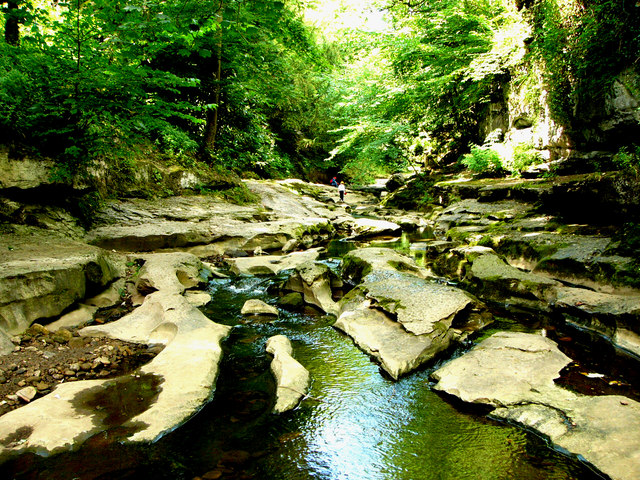
How Stean Gorge. Great view of the rock formations and the sun coming through a small gap in the trees
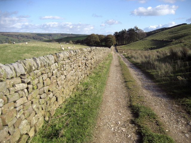
The Nidderdale Way follows a track and bridleway at this point, a mile from Brimham Rocks. A section of the Monk Wall stands to the right of the track.
Elevation Profile


