Ogden Reservoir and Piethorne Reservoir Walk
![]()
![]() Explore this area of the Piethorne Valley on this circular walk in the Metropolitan Borough of Rochdale, Greater Manchester. There's a nice walking trail taking you around Ogden Reservoir, Kitcliffe Reservoir and Piethorne Reservoir. You'll climb above the reservoirs and enjoy wonderful views over the surrounding countryside. There's also waterfalls, woodland and lots of wildlife to look out for on the way.
Explore this area of the Piethorne Valley on this circular walk in the Metropolitan Borough of Rochdale, Greater Manchester. There's a nice walking trail taking you around Ogden Reservoir, Kitcliffe Reservoir and Piethorne Reservoir. You'll climb above the reservoirs and enjoy wonderful views over the surrounding countryside. There's also waterfalls, woodland and lots of wildlife to look out for on the way.
The Rochdale Way and the Pennine Bridleway both pass the reservoirs so you can pick up these trails to further explore the Piethorne Valley. If you head north you will pass Tunshill Hill, Dick Hill, the Longden End Brook and Rakewood before coming to the lovely Hollingworth Lake. The large lake has a nice waterside footpath and a nature reserve with lots of birdlife to look out for.
About 2.5 miles to the south east you will find Castleshaw Reservoirs. There's nice trails here around the upper and lower reservoirs, with parking available at the Castleshaw Centre.
Ogden and Piethorne Reservoirs are located near Newhey and Oldham.
Postcode
OL16 3TQ - Please note: Postcode may be approximate for some rural locationsOgden Reservoir and Piethorne Reservoir Ordnance Survey Map  - view and print off detailed OS map
Ogden Reservoir and Piethorne Reservoir Open Street Map  - view and print off detailed map
Ogden Reservoir and Piethorne Reservoir OS Map  - Mobile GPS OS Map with Location tracking
Ogden Reservoir and Piethorne Reservoir Open Street Map  - Mobile GPS Map with Location tracking
Pubs/Cafes
The Bulls Head pub is conveniently located a stones throw from Ogden Reservoir. It's a friendly pub with a good menu and a walkers and cyclists special. You can pre-order your meal before your walk or cycle so they can have it ready for when you want it or on your return. You can find the pub just to the south of the reservoir at a postcode of OL16 3TD.
Dog Walking
The reservoirs are a great place to take your dog and the Bulls Head mentioned above is also dog friendly.
Further Information and Other Local Ideas
The Piethorne Valley is a great area for bird spotting with curlews, meadow pipits, wheatears, skylarks, and great crested grebes on the water. You may also see birds of prey such as buzzards and peregrines in the area.
Just to the south you can pick up the Crompton Circuit and enjoy a circular walk around Shaw and Crompton Moor.
To the north there's the Station to Station Walk which will take you up to Turf Hill where there's some fine views over the valley.
Cycle Routes and Walking Routes Nearby
Photos
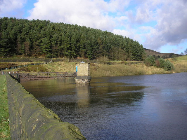
Ogden Reservoir. The control tower seen from the dam with woods in the background. Take in February 2008
Piethorne Reservoir. Looking northeast through the waterworks gate at the southern end of the reservoir dam wall. Windy hill transmitter mast can be seen on the skyline. An Ordnance Survey benchmark has been carved into the bottom of the stone gatepost.


