Dalkeith Country Park Walk
![]()
![]() This large country park near Edinburgh has a number of excellent walking and cycling paths. The waymarked walking trails run through the ancient oak woodland and along the River Esk which runs through the park. Cyclists can follow the miles of estate roads and then follow a lovely off road path along the River Esk to Musselburgh on the coast.
This large country park near Edinburgh has a number of excellent walking and cycling paths. The waymarked walking trails run through the ancient oak woodland and along the River Esk which runs through the park. Cyclists can follow the miles of estate roads and then follow a lovely off road path along the River Esk to Musselburgh on the coast.
Look out for an abundance of wildlife including deer, foxes, herons and otters.
To extend your walking in the area you could head into Holyrood Park in the city and climb to Arthur's Seat. This splendid hike is a real highlight of the area, commanding fine views over city and the coast. Also nearby is Bonaly Country Park where there are more good cycling and walking trails to try.
Please click here for more information
Dalkeith Country Park Ordnance Survey Map  - view and print off detailed OS map
Dalkeith Country Park Open Street Map  - view and print off detailed map
Dalkeith Country Park OS Map  - Mobile GPS OS Map with Location tracking
Dalkeith Country Park Open Street Map  - Mobile GPS Map with Location tracking
Pubs/Cafes
The Restoration Yard is the on site shop and cafe in the park. There's a great choice of food and nice views of the herb garden through the window.
Just to the north east of the park there's the excellent Mercat Grill. They do very good food and also have a superb garden area with tables and chairs for alfresco dining. You can find the bar at 10 Whitecraig Rd, Whitecraig with a postcode of EH21 8PG for your sat navs.
Dog Walking
The park is great for dog walking with miles of woodland trails to try. They are also allowed off lead for most of the waymarked footpaths. There is some livestock in the ares so it's best to keep them on leads here.
The Mercat Grill mentioned above is also dog friendly, even serving up dog beers and gourmet treats for your four-legged friend!
Further Information and Other Local Ideas
The Penicuik to Dalkeith Railway Walk can be picked up near the park. It takes you through some of Midlothian’s historic villages on an easy path.
Just to the east of the park you can explore the historic Carberry Hill and pick up the Pencaitland Railway Walk. The trail runs along a dismantled railway and is suitable for both walkers and cyclists. Similarly the Haddington to Longniddry Railway Walk runs between the two East Lothian towns for a distance of about 5 miles. Near here you'll also find the Gosford Estate where there's some nice trails to follow around the grounds of grand mansion.
Just to the south of Arthur's Seat there's the pretty Duddingston Loch to explore. There's some nice waterside paths and the splendid Dr Neil's Garden to enjoy here. There's also some history in Duddingston village with a 12th century church and a 14th century pub, thought to be oldest in Scotland.
Also in the Dalkeith area is Vogrie Country Park where you'll find some attractive parkland and gardens surrounding the baronial-styled Vogrie House.
For more walks in the area see the Edinburgh Walks page.
Cycle Routes and Walking Routes Nearby
Photos
The Conservatory, Dalkeith country park. Conservatory, now ruined, built about 1832 to a design by William Burn and used to grow exotic fruits for the Duke of Buccleuch at Dalkeith House. The boiler was said to consume up to a ton of coal a day.
Ancient Oaks in Dalkeith Country Park. Some of the many very old oaks in this park, a lot now showing signs of their age.
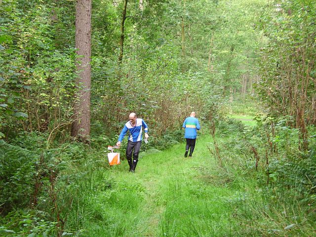
Control punching, Dalkeith Park An orienteering control in action: competitors prove they have completed the course by placing a chip into a box at the flag. The memory chip carried by the runner then has the time of visit recorded. At the finish, the time is calculated by computer and the runner gets a printout of all the times between controls on the course. Orienteering is cross country running, where shortcuts are allowed. The course is defined by a series of flags. You have to visit the flags in order,as fast as possible, the trick being to also work out from a map the quickest route.
The Montagu bridge in Dalkeith Country Park crosses the North Esk river. The bridge was built in 1792 and was a gift from the Montagu family on the occurrence of a marriage between their family and the Queensberry family.


