Gartmorn Dam Walk with OS Map
![]()
![]() This 370 acre Country Park and Nature Reserve is located less than two miles from Alloa and Clackmannan in Clackmannanshire. The centrepiece of the park is the 170 acre Gartmorn Dam reservoir which has a lovely waterside path and is surrounded by peaceful woodlands. The park is very good for wildlife watching - look out for woodpeckers, roe deer, hare and red squirrels in the woodland areas and various wildfowl on the reservoir.
This 370 acre Country Park and Nature Reserve is located less than two miles from Alloa and Clackmannan in Clackmannanshire. The centrepiece of the park is the 170 acre Gartmorn Dam reservoir which has a lovely waterside path and is surrounded by peaceful woodlands. The park is very good for wildlife watching - look out for woodpeckers, roe deer, hare and red squirrels in the woodland areas and various wildfowl on the reservoir.
Other features in the park include an 18th century Ice House, the 19th century kitchen garden, a bird hide, picnic areas and a visitor centre.
If you'd like to continue your walk/cycle then the Dunfermline to Alloa path runs just to the south of the park. It follows National Cycle Network route 764 and the trackbed of a disused railway line from Dunfermline to Alloa via Clackmannan and Carnock.
Postcode
FK10 3NZ - Please note: Postcode may be approximate for some rural locationsGartmorn Dam Country Park Ordnance Survey Map  - view and print off detailed OS map
Gartmorn Dam Country Park Open Street Map  - view and print off detailed map
*New* - Walks and Cycle Routes Near Me Map - Waymarked Routes and Mountain Bike Trails>>
Gartmorn Dam Country Park OS Map  - Mobile GPS OS Map with Location tracking
Gartmorn Dam Country Park Open Street Map  - Mobile GPS Map with Location tracking
Pubs/Cafes
There's a nice on site cafe with indoor and outdoor seating at the site.
Dog Walking
The dam is a popular place for dog walkers so you'll probably bump into other owners on your visit.
Further Information and Other Local Ideas
To continue your exercise in the area you could head to Lochore Meadows Country Park, Loch Fitty, Loch Leven or Townhill Country Park in nearby Dunfermline. There's lots of good waterside footpaths to enjoy at these venues.
The National Trust's splendid Dollar Glen is just a few miles north east while to the north there's Alva Glen with its lovely waterfalls and views of the Ochil Hills. Near here there's trails along the River Devon and a series of lovely reservoirs in Glendevon. There's also the Cleish Hills to explore around the pretty Loch Glow.
Cycle Routes and Walking Routes Nearby
Photos
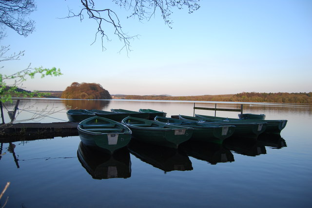
View across to the island on Gartmorn Dam from the fishermens' jetty. Gartmorn was built in 1712 as a reservoir to supply water to hydraulic machines used in Alloa's mining industry. It is one of the earliest reservoirs in the country.
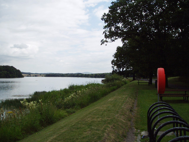
This picture taken from near Gartmorn Dam House shows the 170 acre reservoir which was created by Sir John Erskine to power the pumps which drained the mines at Sauchie. Today it is an area of Special Scientific Interest and is an important site in the winter months for migratory Wildfowl. The reservoir's dam, some 320 yards (290 m) in length, was reconstructed in hewn stone in 1785.


