Humber Bridge Country Park
![]()
![]() This Country Park and Local Nature Reserve consists of woods, meadows, ponds and cliffs.
This Country Park and Local Nature Reserve consists of woods, meadows, ponds and cliffs.
From the park there are dramatic views over the River Humber and the iconic Humber Bridge in East Riding of Yorkshire. There are three lovely nature trails waymarked with hand carved owls, rabbits and frogs. You can also follow The Phoenix Sculpture Trail which winds its way through the woods and features 10 unique sculptures. If you are on your bike please cycle carefully on the designated paths.
If you would like to extend your cycle or walk then you can follow the Trans Pennine Trail west along the River Humber to North Ferriby. Our Hessle Foreshore Walk will take you in the other direction along the pretty banks of the river to Hull.
A walking and cycling trail will also take you across the bridge to Barton-on-Humber. You can pick this up from the country park on our Humber Bridge Walk. On the other side of the river you'll find Barton Upon Humber's lovely Waterside Nature Reserve which is a great place for looking out for the riverside birds.
Humber Bridge Country Park Ordnance Survey Map  - view and print off detailed OS map
Humber Bridge Country Park Open Street Map  - view and print off detailed map
Humber Bridge Country Park OS Map  - Mobile GPS OS Map with Location tracking
Humber Bridge Country Park Open Street Map  - Mobile GPS Map with Location tracking
Dog Walking
The park is popular with dog walkers so you'll probably see other owners on your visit. The woodland trails are ideal for dogs but please keep them under control due to the wildlife.
Further Information and Other Local Ideas
On the north western side of Hull you'll find Cottingham and the worthy village of Skidby. The main attraction here is the Grade II listed Skidby Mill which dates back to 1821. The working mill includes an interesting museum and a fine restaurant with a landscaped garden.
Head east into Hull and you can explore the docks and visit The Deep, a huge aquarium with over 3500 fish.
Cycle Routes and Walking Routes Nearby
Photos
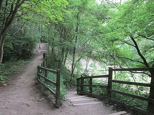
One of the footpaths in late spring. Otherwise known as "Little Switzerland". This is a former chalk quarry converted into a recreational area.
Looking east along the track above the western pool, in the former quarry where chalk was excavated and crushed to make the 'whiting' used in paints, cosmetics and bread. The chalk pit became flooded every winter and was eventually abandoned in 1960. It has been a popular recreation area ever since, becoming known locally as 'Little Switzerland'.
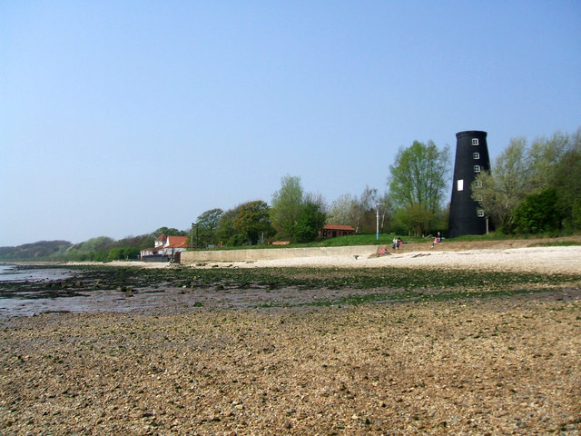
Cliff Mill, Hessle. Cliff Mill (a.k.a. Black Mill) dwarfed by the north tower of the Humber Bridge at Hessle. The windmill was very distinctive because it had five sails instead of the usual four, although it seems unlikely it would have been painted black when in use as its purpose was to crush chalk boulders to make the 'whiting' used in paints, cosmetics and bread. The nearby pit which provided the chalk (now the Humber Bridge Country Park) became flooded every winter and was eventually abandoned in 1960.


