Lochore Meadows Country Park
![]()
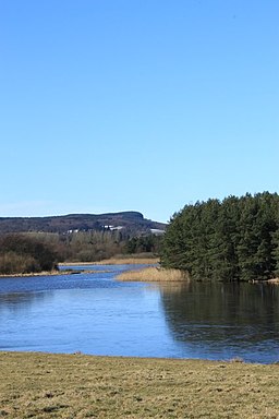
![]() Enjoy lovely waterside walking and cycling in this country park in Fife. The centrepiece of park is the beautiful Loch Ore which is surrounded by woodlands, meadows, grasslands, ponds and a Nature Reserve. You can explore the park on four way-marked trails of varying lengths and difficulty. The routes take you to Lochore Castle, Harran Hill Wood (with ancient woodland), Harran Hill (where there are fine views of the park) and over the Clune where there are archaeological features dating back to the Bronze Age.
Enjoy lovely waterside walking and cycling in this country park in Fife. The centrepiece of park is the beautiful Loch Ore which is surrounded by woodlands, meadows, grasslands, ponds and a Nature Reserve. You can explore the park on four way-marked trails of varying lengths and difficulty. The routes take you to Lochore Castle, Harran Hill Wood (with ancient woodland), Harran Hill (where there are fine views of the park) and over the Clune where there are archaeological features dating back to the Bronze Age.
The park is located just north of Cowdenbeath and Dunfermline and just a couple of miles south of Loch Leven.
To continue your walking in the area head north to Loch Leven and enjoy the circular heritage trail around the water.
Lochore Meadows Country Park Ordnance Survey Map  - view and print off detailed OS map
Lochore Meadows Country Park Open Street Map  - view and print off detailed map
Lochore Meadows Country Park OS Map  - Mobile GPS OS Map with Location tracking
Lochore Meadows Country Park Open Street Map  - Mobile GPS Map with Location tracking
Pubs/Cafes
The Willie Clarke Visitor Centre is also home to the Lochside Café. It offers lovely views across the loch and is open 7 days, offering hot and cold food and drinks. The café currently serves a selection of breakfast rolls, soup, sandwiches, toasties, hot and cold drinks, cakes and snacks. A takeaway service is also available if you'd prefer to eat outside at the nearby picnic benches.
Further Information and Other Local Ideas
Just a couple of miles north east of Dunfermline there's some more peaceful lochside trails along Loch Fitty.
A few miles to the east there's the Cleish Hills to explore around the pretty Loch Glow.
A few miles to the north you'll find one of the walking highlights of the area at Maspie Den. The den is located just west of the historic village of Falkland and includes peaceful woodland and series of picturesque waterfalls.
To the north east there's the Glen Vale Waterfalls and John Knox's Pulpit Walk where you can enjoy a walk along the pretty Glen Burn to the historic natural pulpit of preacher John Knox.
Cycle Routes and Walking Routes Nearby
Photos
Lochore Castle. Standing within Lochore Meadows Country Park this is the remains of a fourteenth century castle.
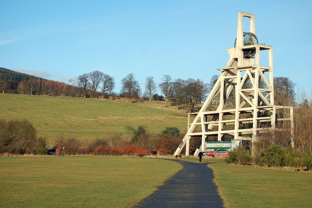
Monument at Lochore Meadows. The site of the Mary No. 2 shaft is marked by its reinforced concrete, pithead frame and winding gear monument. It is one of only two such structures in Fife serving to remind the public of the Kingdom's great mining history. The Mary Pit was named after the wife of Charles Carlow, who was the mine owner.
Bench by the loch. The park lies in the heart of the Lomond Hills Regional Park West. It is a major centre for outdoor and environmental education in Fife. The Country Park is an attractive area, comprising reclaimed coal mining waste-land, gently rolling grassland and woodland. It covers an area of 1,200 acres, 260 of which form Loch Ore.


