National Cycle Route 8 - Lon Las Cymru
![]()
![]() This epic Sustrans cycle route runs for nearly 250 miles through some of Wales' most beautiful scenery.
This epic Sustrans cycle route runs for nearly 250 miles through some of Wales' most beautiful scenery.
The route runs from Cardiff to Anglesey, passing through the stunning Brecon Beacons and Snowdonia National Parks.
It's a challenging ride with several hill climbs with fabulous views as your reward. There are also some easier coastal sections to enjoy towards the end of the route.
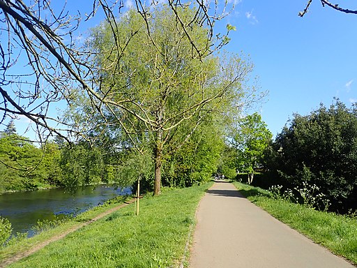
The opening section from Cardiff uses the popular Taff Trail with fine views of the River Taff and traffic free runs along old railway lines.
See the links below for the route split into manageable day ride sections.
Scroll further down for videos and a gpx file for the whole route.
Cycle Routes along National Cycle Route 8
- Taff Trail - Follow the River Taff, from Cardiff to Brecon, on this fantastic waterside cycling and walking route.
You start on the River Taff in Cardiff and head along the river northwards passing the Millennium Stadium and Cardiff Castle - Cardiff Bay Trail - This circular walking and cycling route explores the redeveloped Cardiff Bay with its marinas, shops, cafes and historic buildings.
- Merthyr Tydfil to Brecon - This spectacular ride follows National Cycle route 8 through the Brecon Beacons National Park
- Builth Wells to Rhayader - Travel through Powys along the trail on this picturesque ride from Builth Wells to Rhayader
- Machynlleth to Llanidloes - Follow the trail from Machynlleth to Llanidloes and enjoy some splendid scenery.
You start off with a lovely run along the River Dulas and some beautiful mountainous scenery around Dylife and Aberhosan - Barmouth to Machynlleth - Travel from Barmouth to Machynlleth along National Cycle 8 route through the Snowdonia National Park
You start in Barmouth on the sea front and then cross the Barmouth Bridge over the Afon Mawddach river - Barmouth to Tywyn - Travel from Barmouth to Tywyn along NCN 8 route through the incredible Porthmadog to Barmouth - Follow the trail on this lovely coastal ride that passes through the breathtaking Snowdonia National Park.
- Lon Eifion - This splendid cycling and walking trail runs along a disused railway path from Caernarfon to Bryncir on the edge of the Snowdonia National Park
- Holyhead to Caernarfon - Follow the trail through Anglesey and over the Menai bridge into Wales.
You start in Holyhead passing through Penrhos Coastal Park and the village of Valley before heading through Anglesey to the Menai Bridge on quiet country roads
National Cycle Route 8 Ordnance Survey Map  - view and print off detailed OS map
National Cycle Route 8 Open Street Map  - view and print off detailed map
National Cycle Route 8 OS Map  - Mobile GPS OS Map with Location tracking
National Cycle Route 8 Open Street Map  - Mobile GPS Map with Location tracking
Further Information and Other Local Ideas
The Chepstow to Glasbury section runs along National Cycle Route 42 which includes good views of the River Usk and a visit to the ancient Llanthony Priory.
Cycle Routes and Walking Routes Nearby
Photos
Lôn Las Cymru, Tywi Valley, Powys. The cycle route has come through the forest on a very long and winding route, and here returns to the byway less than a mile and a half from where it left it. Something similar happens further west and I can only assume it is to bypass the several fords of varying depth that the drovers' route involves.
Millennium Bridge Opened in October 2001 as part of Lon Las Cymru, the Welsh National Cycle Network. This footbridge/cycle bridge bypasses the Dyfi bridge on the A487.
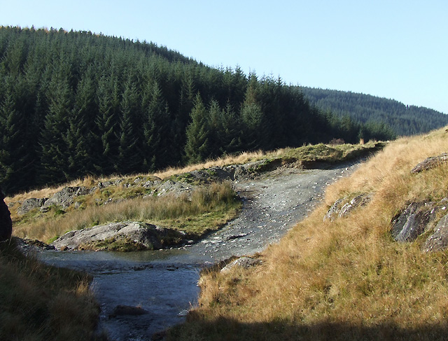
Byway to Strata Florida, Powys. Here Nant Tadarn crosses the track on its descent to the Afon Tywi. The ford looks quite benign today, about 15cm in depth, following a few days of dry weather. However, after heavy rain it can be dangerous and/or impassable. A temporary road sign is available about half a mile south of here announcing (bilingually) "fords - road closed". The road/track shown is "open to all traffic", and leads eventually towards Strata Florida, linking with the National Cycle Route 8 (Lon Las Cymru) in the Tywi Forest ahead.
The ford, Nant Tadarn by Carreg y Fran, Powys Here Nant Tadarn crosses the track on its descent to the Afon Tywi. The ford looks quite benign today, about 15cm in depth, following a few days of dry weather. However, after heavy rain it can be dangerous and/or impassable. A temporary road sign is available about half a mile south of here announcing (bilingually) "fords - road closed". The road/track shown is "byway open to all traffic", and leads eventually towards Strata Florida, linking with the National Cycle Route 8 (Lon Las Cymru) in the Tywi Forest ahead.


