Dylife Waterfall Walk
![]()
![]() This circular walk visits the wonderful Ffrwd Fawr waterfall from the village of Dylife in Powys.
This circular walk visits the wonderful Ffrwd Fawr waterfall from the village of Dylife in Powys.
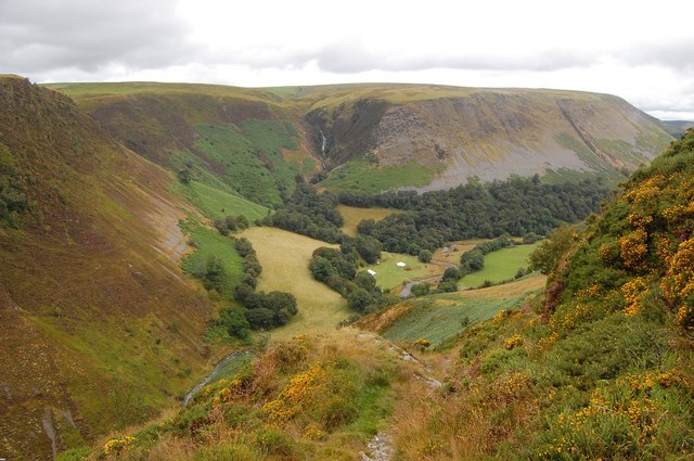
On the way you will also pass the old mine workings, revealing the industrial history of the area. The route then passes the Dylife Look out point where there are some spectacular views over the gorge. This area also has a car park and an information board.
On the eastern section you will climb to an excellent spot with great views down to the falls.
The epic Glyndwr's Way passes just to the south. You could pick up this waymarked trail to further explore the area.
Dylife Waterfall Walk Ordnance Survey Map  - view and print off detailed OS map
Dylife Waterfall Walk Open Street Map  - view and print off detailed map
Dylife Waterfall Walk OS Map  - Mobile GPS OS Map with Location tracking
Dylife Waterfall Walk Open Street Map  - Mobile GPS Map with Location tracking
Further Information and Other Local Ideas
To the south there's the expansive Llyn Clywedog where there are miles of great waterside cycling and walking trails.
Just to the west there's the Glaslyn Nature Reserve where you can enjoy a circular walk around a tranquil lake and look out for a variety of interesting flora and fauna.
Cycle Routes and Walking Routes Nearby
Photos
Part of the gorge on the Afon Twymyn below Dylife. Before the last Ice age, the River Twymyn did not flow through the valley. When the valley was filled by a glacier, the ice ground out a U-shaped glaciated valley. When the glacier that filled the valley melted the Twymyn started to run down the wide channel left behind and the fast flowing river further eroded the valley, cutting the V-shaped gorge as seen today.


