Rebellion Way Cycle Route
![]()
![]() This long distance circular cycle route explores the highlights of the county of Norfolk.
This long distance circular cycle route explores the highlights of the county of Norfolk.
The epic trail runs for 232 miles visiting many of the county's highlights on a series of quiet country lanes and traffic free paths.
The ride starts in the centre of Norwich but Thetford, King’s Lynn, Sheringham and Cromer are other good options with good facilities and train stations. From Norwich the trail first takes you east to explore the Norfolk Broads, passing through several pretty Broads villages such as Wroxham and Hoveton. See the Norwich To Wroxham Cycle Route page for more details on this opening section.
Around Buxton and Aylsham you'll enjoy a traffic free run along the popular Bure Valley Path, a multi user trail running along an old railway.
Soon after you come to the historic Blickling Hall where there's some lovely walks around the extensive grounds.
You continue north to another route highlight at Felbrigg Hall Park where there are off road trails through the attractive woodland and parkland.
The route continues to the coast at Sheringham where there's a nice beach and more lovely traffic free trails around the expansive Sheringham Park and the old Sheringham Hall.
You continue through the countryside to Holt where you will skirt the edge of the pretty Holt Country Park before passing Gunthorpe and Great Walsingham.
Shortly after you will arrive back at Wells-Next-the-Sea where there is a lovely traffic free coastal section along Holkham Meals. In this area you will also pass along Holkham Park where there is an historic hall and parkland with a lake and deer.
A countryside section follows before arriving back at the coast at Hunstanton. There's another nice seaside section along the lovely beaches here.
The route then heads south passing the Roman site at Snettisham, the wildlife rich Dersingham Bog and Sandringham Country Park. A cycle trail runs through this popular park taking you past the famous house and through the peaceful woodland.
You continue south to Castle Rising and King's Lynn.
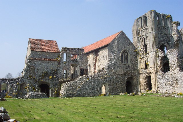
From here you head east through Bawsey Pits Country Park and Gayton before turning south to Castle Acre. Here you'll find a fascinating ancient castle and some glorious views over the River Nar Valley.
The next stage takes you south to Swaffham and Oxburgh where you will pass another route highlight at the National Trust's Oxburgh Hall.
You then pass through the woodland of the Brecks and Thetford Forest with a visit to the delightful Lynford Arboretum on the way.
You'll then pass through the town of Thetford with its old priory and river trails, before heading east towards Diss. From here you head north passing through a series of South Norfolk villages and returning to Norwich.
Please click here for more information
Rebellion Way Ordnance Survey Map  - view and print off detailed OS map
Rebellion Way Open Street Map  - view and print off detailed map
Rebellion Way OS Map  - Mobile GPS OS Map with Location tracking
Rebellion Way Open Street Map  - Mobile GPS Map with Location tracking
Further Information and Other Local Ideas
The route links up at various points with National Cycle Network Regional Route 30. Another long distance circular ride the route can be picked up in Thetford, Dersingham, Sandringham Country Park, King's Lynn and Diss. It includes some nice coastal sections around Cromer and Great Yarmouth.


