Thetford Forest Walks and Cycling
![]()
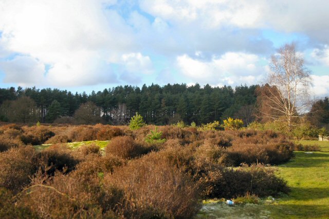
![]() Enjoy miles of cycling and walking trails in this large forest in Suffolk.
Enjoy miles of cycling and walking trails in this large forest in Suffolk.
Cyclists will find 4 way-marked trails of varying distance and difficulty. The Shepherd Trail is a nice easy ride on well defined paths, suitable for families. Experienced mountain bikers can try the exciting Beater trail which takes you through beautiful beech woods on a single track.
Walkers can enjoy a number of way-marked walks such as the lovely Nature Trail. This walk features a viewing hide where you can look out for the wildlife in the forest. This includes four types of deer and countless varieities of birds and butterflies.
The circular route below starts at the visitor centre and follows cycling and walking tracks around the centre of the forest.
If you would like to continue your excercise you could head to the nearby Brandon Country Park. Here you will find beautiful lakeside lawns, a delightful walled garden and an excellent visitor centre.
The super Little Ouse Path walking route also runs through the forest. Head a few miles north towards Lynford and you will find the delightful Lynford Arboretum with its peaceful, woodland walking trails.
Postcode
IP27 0AF - Please note: Postcode may be approximate for some rural locationsPlease click here for more information
Thetford Forest Ordnance Survey Map  - view and print off detailed OS map
Thetford Forest Open Street Map  - view and print off detailed map
Thetford Forest OS Map  - Mobile GPS OS Map with Location tracking
Thetford Forest Open Street Map  - Mobile GPS Map with Location tracking
Pubs/Cafes
At the High Lodge visitor centre there's a good cafe selling a range of meals and snacks. Near the visitor centre there's also the delightful St Helen's Picnic Site if you'd prefer to bring your own food. The site is located in a lovely spot in Santon Downham next to the River Ouse. There's free parking and a number of good walking trails branching off from the site. Snowdrops can also be seen at in the early spring in the woodland opposite the village shop. You can find the site at Santon Downham with postcode IP27 0TJ for your sat navs. Also in the village you a visit to the noteworthy Santon Downham Church is worth a little of your time. Dedicated to St Mary the Virgin, parts of this church date back to the 12th century, although the tower was built in the 15th century.
To the south there's the Elveden Estate where there's miles of walking trails surrounding the historic Georgian mansion. The estate also includes a number of fine shops selling quality produce, the excellent Elveden Courtyard restaurant and the Elveden Inn. The inn is considered to be the 'home of Guinness' in England as the estate is the seat of a direct descendant of the Guinness family. You can find them just a few miles north east of the walk in the village of Elveden at postcode IP24 3TJ.
Dog Walking
As you'd expect the miles of woodland trails are ideal for dog walking so you're bound to bump into other owners on your visit. You can have them off leads to as long as they are under control. The on site cafe mentioned above is dog friendly and dogs are also welcome at the St Helen's Picnic Site.
Further Information and Other Local Ideas
One nice idea is to pick up the St Edmund Way at Thetford Priory and follow the waymarked trail south through the King's Forest to West Stow Country Park and Lackford Lakes Nature Reserve. There's some nice waterside trails here around the park's lakes and along the River Lark which runs through the area.
For cyclists try the Thetford Cycle Loop to extend your exercise. This 30 mile waymarked trail takes you around the forest, visiting several villages, heaths, nature reserves and rivers. There's also the long distance Rebellion Way Cycle Route. The epic 232 mile circular ride visits some of the major highlights of Norfolk, using a series of quiet country lanes and traffic free paths.
The Thetford Warren Lodge Fir Trail follows a series of peaceful woodland trails and also visits the 15th century Thetford Warren Lodge. The lodge is an English Heritage property which protected gamekeepers and hunting parties against armed poachers.
Cycle Routes and Walking Routes Nearby
Photos
Big Wood. A group of walkers head along this forest walk leading away from Lynford Stag picnic site towards Lynford Hall. Thetford Forest is the largest lowland pine forest in Britain, started in the 1920s as a strategic timber reserve on the Breckland heaths which were of little agricultural value.


