Askham Fell and Beck Circular Walk
![]()
![]() This circular walk climbs to the viewpoint at Askham Fell from the Lake District village of Askham. The fell is situated on the eastern side of the National Park, close to the popular town of Penrith.
This circular walk climbs to the viewpoint at Askham Fell from the Lake District village of Askham. The fell is situated on the eastern side of the National Park, close to the popular town of Penrith.
From the summit there are excellent views to the surrounding fells and down to the nearby Ullswater Lake.
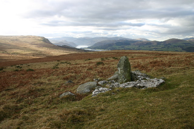
The walk starts in the village and heads west along Askham Beck to Don Bottom, Haber Hill and Ringingleys Top before coming to Heughscar Hill. There's a boundary stone here and fine views to enjoy.
The route then heads south east across Askham Fell and Moor Divock before descending to a country lane. Follow this lane east and it will take you to Helton and the River Lowther where you turn north along a riverside path. You'll pass Gillrigs and Keldron Spring before returning to the village.
Please click here for more information
Askham Fell Ordnance Survey Map  - view and print off detailed OS map
Askham Fell Open Street Map  - view and print off detailed map
Askham Fell OS Map  - Mobile GPS OS Map with Location tracking
Askham Fell Open Street Map  - Mobile GPS Map with Location tracking
Further Information and Other Local Ideas
To continue your walking in the area you could visit the nearby Askham Hall where there are some beautiful grounds and gardens. The historic ruins of Lowther Castle are also nearby.
Just to the east is the small village of King's Meaburn where you can enjoy a walk along the River Lyvennet and visit Jackdaw's Scar, an impressive limestone outcrop popular with rock climbers.
Just to the south west of the fell there's Bonscale Pike and Arthur's Pike. They are both fine Ullswater viewpoints with the photogenic Bonscale Tower a highlight on the walk. You can reach the fells from Askham Fell by following trails south west to Barton Fell. There is also the old Roman Road bridle track which leads in that direction.
For more walking ideas in the area see the Lake District Walks and the Cumbria Walks pages.
Cycle Routes and Walking Routes Nearby
Photos
Ponies above Askham. The track at right of shot is the bridleway to Moor Divock. The better surfaced track leads to a farm.


