Atherstone Walks
![]()
![]() This Warwickshire based market town has come nice canal side trails and nearby pockets of woodland to explore.
This Warwickshire based market town has come nice canal side trails and nearby pockets of woodland to explore.
This circular walk from the town takes you along a section of the Coventry Canal to the nearby Hartshill Country Park.
Start the walk from the train station where you can pick up the towpath of the canal just to the north. Follow it south and it will take you past an impressive flight of eleven locks.
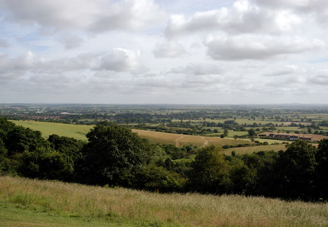
You continue south east and past Outwood Bridge, Rawn Hill and Mancetter before coming to Hartshill. Here you leave the canal to head south west to Hartshill Hayes Park. Here you'll find 137 acres of woodland and open hilltop with magnificent views across the Anker Valley from the high points.
The path then passes the Odbury Camp hillfort before heading north to return to the canal. You can then follow the towpath back into Atherstone.
Atherstone Ordnance Survey Map  - view and print off detailed OS map
Atherstone Open Street Map  - view and print off detailed map
Atherstone OS Map  - Mobile GPS OS Map with Location tracking
Atherstone Open Street Map  - Mobile GPS Map with Location tracking
Pubs/Cafes
The Kings Head near the start of the walk is a good choice for refreshments. The pub is located in a great spot next to the canal and includes a lovely garden area with views over the water. They have a good menu and can be found close to the train station on Old Watling St with a postcode of CV9 2PA for your sat navs.
Dog Walking
The canal and woodland trails make for a fine dog walk and the Kings Head mentioned above is also dog friendly.
Further Information and Other Local Ideas
You can continue exploring the canal on the Tamworth Canal Walk. Highlights on the route include Fazeley Junction and the nearby Pooley Country Park.
At Hartshill Park you can pick up the Warwickshire Centenary Way. This long distance footpath is a great way of exploring the countryside and villages in the county.
In Hartshill Park you can pick up the Nuneaton Circular Walk. You can follow this waymarked trail to explore the area around the nearby town. On the way there's a visit to the historic Arbury Hall and the Ashby Canal.
For more walking ideas in the area see the Warwickshire Walks page.
Cycle Routes and Walking Routes Nearby
Photos
Atherstone Locks No 2, Coventry Canal, Warwickshire. This is the second lock of eleven lowering the water level by eighty feet (24.4 metres) over about two miles (three kilometres). As the canal company had run out of money by 1771 when it reached Atherstone on its course from Coventry, these locks and the rest of the route were constructed later, eventually arriving at Fazeley in 1790.
Atherstone Top Lock. This is the first lock of eleven lowering the water level by eighty feet (24.4 metres) over about two miles (three kilometres).


