Bearsted Walks
![]()
![]() This attractive Kent based village has a pretty village green, a local community run woodland park and easy access to the footpaths on the North Downs.
This attractive Kent based village has a pretty village green, a local community run woodland park and easy access to the footpaths on the North Downs.
The village is also easily accessible with a train station on the Southeastern Maidstone East Line. It's located just two miles east of Maidstone town centre.
This circular walk from the village visits the Bearsted Woodland Trust before heading up to the North Downs Way to visit neighbouring Thurnham where you can visit the ruins of Thurnham Castle.
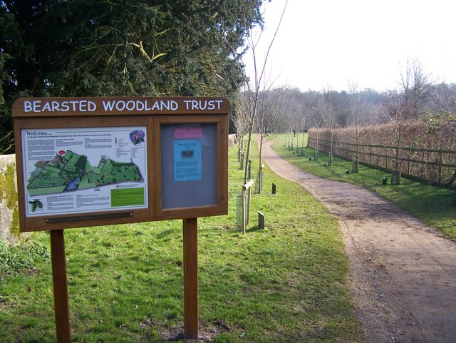
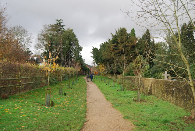
The walk starts in the village centre where you can visit the Bearsted Woodland Trust on the eastern side. There's some nice trails to follow around this pleasant area with a lake, ponds, cherry tree avenue and streams to see.
After exploring the woodland park you can follow footpaths north east to Barton Farm before heading underneath the motorway to Longham Wood. Continue north for another mile or so and you will come to the North Downs Way. You can follow the waymarked trail west to Civiley Wood before coming to the remains of Thurnham Castle. This 12th-century flint-built castle was constructed by Robert of Thurnham in the reign of Henry II. One side of the bailey wall still stands 10 foot high and originally it enclosed an area of about a quarter of an acre.
After exploring the castle you could continue west for a short distance to climb to the viewpoint on Detling Hill in the White Horse Wood Country Park. This route follows Thurnham Lane south to return to the village.
Postcode
ME14 4EJ - Please note: Postcode may be approximate for some rural locationsBearsted Ordnance Survey Map  - view and print off detailed OS map
Bearsted Open Street Map  - view and print off detailed map
Bearsted OS Map  - Mobile GPS OS Map with Location tracking
Bearsted Open Street Map  - Mobile GPS Map with Location tracking
Walks near Bearsted
- North Downs Way - This beautiful trail starts in Farnham, Surrey and heads east through the stunning North Downs to the historic city of Canterbury in Kent
- Detling Hill - This walk climbs to Detling Hill, just to the east of the village of Detling in Kent
- Maidstone River Walk - A nice riverside walk along the Medway from Maidstone to Leybourne Lakes Country Park
- Hollingbourne - This attractive Kent based village has some fine trails through the North Downs to try
- Boxley - This little Kent based village is a pleasant place to start a walk
- Pilgrims Way - Follow in the footsteps of the pilgrims who followed this ancient track from Winchester in Hampshire, to the shrine of Thomas Becket at Canterbury in Kent
- Blue Bell Hill - Visit the Blue Bell Hill viewpoint on this circular walk on the North Downs Way
- Hucking Estate - Enjoy a peaceful stroll through the ancient woodland and open grassland of the Hucking Estate in the Kent Downs AONB
- White Horse Wood Country Park - Enjoy fabulous views over the Kent Downs AONB in this new country park near Maidstone
Pubs/Cafes
Head to the Oak on the Green for some post walk refreshment. The historic pub dates back to 1665 and is located in a lovely spot on the village green. They serve good quality food and have a good sized outdoor area with views over the green. You can find them at postcode ME14 4EJ for your sat navs.
Dog Walking
The woodland and country trails make for a fine dog walk. The Oak on the Green mentioned above is also very dog friendly with water and treats available.
Further Information and Other Local Ideas
You can extend the walk by heading west from Detling Hill to visit the worthy village of Boxley. Here you'll find the noteworthy Boxley Warren Nature Reserve and the remains of the 12th century Boxley Abbey.
For more walking ideas in the area see the Kent Downs Walks and North Downs Walks pages.
Photos
Sign at the Bearsted Woodland Trust Community Woodland and open ground beside Bearsted Church. A public footpath leads through it from Church Lane to A20 Ashford Road. Other routes exist in the Trust land. The walk shown in photo is the Cherry Tree Walk.
Cherry Avenue. Bearsted Woodland Trust protects and maintains 16 acres of woodland and meadow near Maidstone.


