Becky Falls
![]()
![]() This is a circular walk in the Dartmoor's Bovey Valley visiting the beautiful Becky Falls and other local landmarks, beauty spots and villages. The falls are one of Dartmoor's premier beauty spots. It's a great area for walkers with 4 colour coded trails taking you through woodland to the Main Falls and the Lower Falls.
This is a circular walk in the Dartmoor's Bovey Valley visiting the beautiful Becky Falls and other local landmarks, beauty spots and villages. The falls are one of Dartmoor's premier beauty spots. It's a great area for walkers with 4 colour coded trails taking you through woodland to the Main Falls and the Lower Falls.
The walk begins in the village of Manaton which is about a mile from the falls. You can park in the village and pick up a footpath through woodland to the falls. The walk then continues through woodland towards the nearby village of Lustleigh. It's worth having a stroll around Lustleigh as it's one of the most picturesque villages in England. You'll see delightful thatched cottages, a 13th-century church, the lovely Primrose Tea Rooms, a cricket field, a communal apple orchard and a splendid village pub.
From Lustleigh you head back into the woodland towards Lustleigh Cleave, passing Sharpitor, Raven's Tor and Hunter's Tor. The Cleave (or 'cliff') is a great place for walkers with lots of footpaths and interesting flora and fauna. Look out for wildlife including deer, butterflies and the dipper bird by the river. In the spring you can also see lots of bluebells and foxgloves.
After passing the Cleave you then cross the River Bovey at Foxworthy Bridge before passing Manaton Rocks and returning to Manaton.
If you'd like to continue your walking in the area then you could climb the nearby Hound Tor for wonderful views over Dartmoor.
Becky Falls are located near Bovey Tracey and Moretonhampstead.
Postcode
TQ13 9UG - Please note: Postcode may be approximate for some rural locationsPlease click here for more information
Becky Falls Ordnance Survey Map  - view and print off detailed OS map
Becky Falls Open Street Map  - view and print off detailed map
Becky Falls OS Map  - Mobile GPS OS Map with Location tracking
Becky Falls Open Street Map  - Mobile GPS Map with Location tracking
Pubs/Cafes
The Bell Inn in Bovey Tracey is a great option for some refreshments. The friendly, cosy pub has a good menu and a very fine garden area to relax in on warmer days. You can find it at Town Hall Place with postcode TQ13 9AA for your sat navs.
Back in Manaton you could try the Kestor Inn. They serve good quality dishes and have a nice garden to sit out in. The pub is dog friendly and located at postcode TQ13 9UF.
Cycle Routes and Walking Routes Nearby
Photos
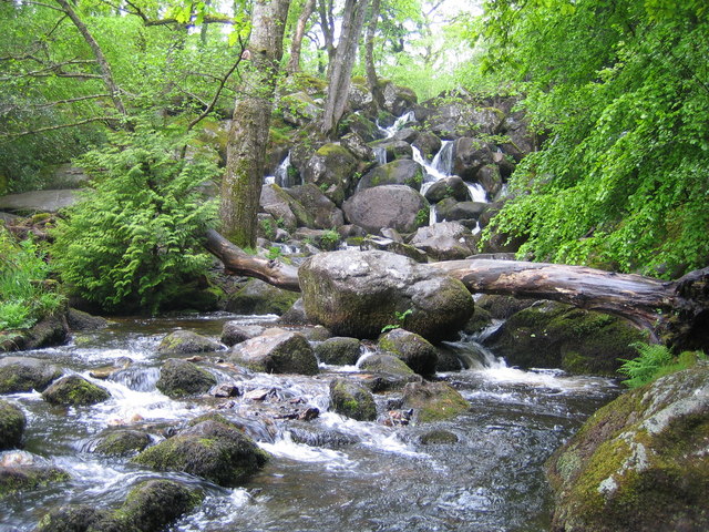
Becky Falls. From a strictly physical geographical point of view this is the Becka Falls waterfall on the Becka Brook, which is a tributary of the River Bovey. The water cascades here over a boulder-strewn bed with a fall of about 70 feet or about 20 metres. However the land in which they occur is privately owned, and the owners have unsurprisingly turned the site into a tourist attraction in which the falls are the centrepiece of a woodland park containing a variety of different features such as a children's zoo, pony paddocks, and a gift shop. In the course of this commercialization the name of the falls has metamorphosed from Becka, as shown on the OS 1940s map, into Becky, as shown on the current OS map. The falls were first made accessible to the public in 1903.
Path and stream, Lower Combe. Lustleigh Footpath 5 runs beside an arm of the stream (flowing towards the camera) down the Combe valley. There have been occasions in the past when the path could scarcely be distinguished from the stream, but it is currently just a little damp.


