Lustleigh Cleave Walk
![]()
![]() The village of Lustleigh is in a nice position for exploring a lovely part of the Dartmoor National Park. This circular walk takes you to Lustleigh Cleave, a 'cliff' or 'cleft', to the east of the village. It's a great place for walkers with many footpaths leading to fields, meadows, woods and riverside trails along the River Bovey.
The village of Lustleigh is in a nice position for exploring a lovely part of the Dartmoor National Park. This circular walk takes you to Lustleigh Cleave, a 'cliff' or 'cleft', to the east of the village. It's a great place for walkers with many footpaths leading to fields, meadows, woods and riverside trails along the River Bovey.
The Cleave is also teeming with interesting flora and fauna. Look out for widlife including deer, butterflies and the dipper bird by the river. In the spring you can also see lots of bluebells and foxgloves.
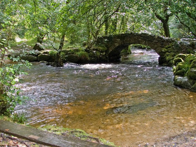
The walk starts in the centre of the village and follows country lanes south west to Pethybridge. Around here you can pick up woodland trails heading north west to Lustleigh Cleave, passing Sharpitor on the way. The walk bends round past Horsham Cleave and picks up woodland trails in Pullabrook Woods. Here you follow a nice waterside path along the River Bovey into Houndtor Wood. You then head through Hisley Wood before returning to the Lustleigh.
The village is also a great place for a stroll with delightful thatched cottages, the lovely Primrose Tea Rooms, a cricket field, a communal apple orchard and a splendid village pub for refreshments after your walk. Also take time to visit the 13th century church where you can see the ancient Datuidoc's Stone which dates from the 6th century.
To continue your walking in the area try the Becky Falls Walk which starts from nearby Manaton. It's a great area for walkers with 4 colour coded trails, taking you through woodland to the Main Falls and the Lower Falls.
Part of this walk uses the Dartmoor Way which runs just to the south of the village. The long distance trail is a great way to see many of the highlights of the National Park. Also nearby is the climb to Hound Tor where you can enjoy fine views over the area.
Lustleigh Cleave Ordnance Survey Map  - view and print off detailed OS map
Lustleigh Cleave Open Street Map  - view and print off detailed map
Lustleigh Cleave OS Map  - Mobile GPS OS Map with Location tracking
Lustleigh Cleave Open Street Map  - Mobile GPS Map with Location tracking
Pubs/Cafes
Head to the aptly named The Cleave Pub for some post walk refreshments. The delightful thatched pub has an attractive interior with features including a low-ceilinged beamed bar with granite walls and log fire. Outdoors there's a nice garden area to relax in on warmer days. The pub is also dog friendly and can be found in the village at a postcode of TQ13 9TJ for your sat navs.
Just to the north west there's the worthy village of North Bovey where you'll find a 14th century church, the fine Bovey Castle Hotel and some pleasant views of the River Bovey.
There's also The Ring of Bells, an historic thatched pub dating back to the 13th century. They have a lovely large garden area with views of the surrounding moorland. There's also a charming old interior with a 15th-century arched door frame, oak doors, low ceilings with beams, open fireplaces and a grandfather clock built into a wall. They serve good food and a fine selection of ales. You can find them at postcode TQ13 8RB for your sat navs. The inn is dog friendly.
Dog Walking
The woodland trails are ideal for a dog walk so you will probably bump into other owners on your visit.
Further Information and Other Local Ideas
If you head about 2 miles north east from the village you will come to Trenchford and Tottiford Reservoir. There's some nice waterside walking trails and peaceful woodland paths to enjoy here. It's a peaceful spot and a worthy addition to your outing.
The Bovey Tracey Walk visits the site from the nearby town. It's a place worth visiting with many listed buildings including a 14th century church and the House of Marbles, a visitor attraction on the site of the historic pottery.
In Lustleigh village you can pick up the Wray Valley Trail. The shared cycling and walking route runs along a disused railway line between Moretonhampstead and Bovey Tracey.
Near Manaton you can climb to the noteworthy Bowerman's Nose. The photogenic rock formation is located in a scenic spot on Hayne Down. The distinctive stack appears on many postcards and calendars of the area.
For more walking ideas in the area see the Dartmoor Walks page.
Cycle Routes and Walking Routes Nearby
Photos
Lustleigh, path to Hunter's Tor. Manaton Rocks are just visible across the valley of the river Bovey, on the left, on the skyline.
Two bridges across the Bovey. The traditional clam bridge, on the right, has been replaced by a new bridge, its appearance denigrated by local campaigners who are upset that the Dartmoor National Park Authority is planning to remove the old bridge, which consists of two logs and a handrail and which needs renewing every 20 years, and is thought to be the last bridge of its kind on Dartmoor.
Lustleigh Cleave near Heaven's Gate. The steep slope of Lustleigh Cleave forms the eastern side of the valley of the River Bovey; here the Cleave is mostly wooded with birch and oak growing between granite boulders, and much bracken. This area was noticeably more open 30 years ago. View west. Picture doesn't really do justice to a very beautiful square.


