Beningbrough Hall Walks
![]()
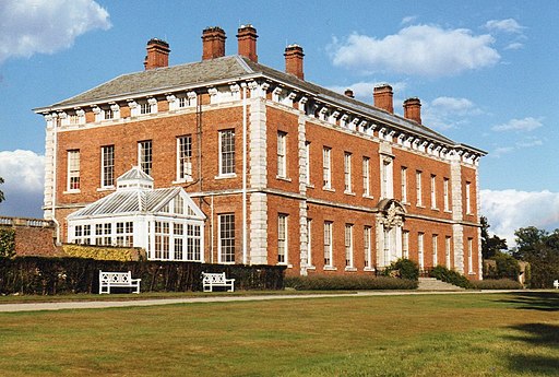
![]() The 18th century Beningbrough Hall has 8 acres of formal gardens to explore including a walled kitchen garden, herbaceous borders and Italian border filled with colourful Mediterranean blooms.
The 18th century Beningbrough Hall has 8 acres of formal gardens to explore including a walled kitchen garden, herbaceous borders and Italian border filled with colourful Mediterranean blooms.
You can also follow footpaths through woodland to the River Ouse where you can enjoy a long waterside stroll. Look out for Oystercatchers, Curlews and Sand Martins along the riverside.
You can tour the Georgian house with its baroque interiors, cantilevered stairs and ornate wood carvings. There's a fine collection of 100 portraits on loan from the National Portrait Gallery featuring influential figures of the era.
If you would like to continue your walk you could follow the River Ouse and the long distance Jorvic Way east towards York.
Heading west will take you through the countryside to Moor Monkton and Tockwith.
Postcode
YO30 1DD - Please note: Postcode may be approximate for some rural locationsPlease click here for more information
Beningbrough Hall Ordnance Survey Map  - view and print off detailed OS map
Beningbrough Hall Open Street Map  - view and print off detailed map
*New* - Walks and Cycle Routes Near Me Map - Waymarked Routes and Mountain Bike Trails>>
Beningbrough Hall OS Map  - Mobile GPS OS Map with Location tracking
Beningbrough Hall Open Street Map  - Mobile GPS Map with Location tracking
Pubs/Cafes
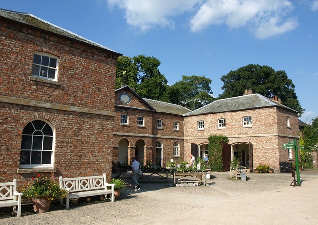
There's a lovely on site cafe where you can enjoy food sourced from the walled garden on the estate.
Dog Walking
Most of the estate is open for dog walkers apart from the walled garden and the play area. You are requested to keep them on leads throughout the estate.
Further Information and Other Local Ideas
The hall is located just a few miles from York. You could follow the River Ouse south east from the hall to take you into the city. Here you can try the York Millennium Way and the York River Walk to explore the area.
Head north and you can visit the worthy town of Easingwold. The attractive market town includes a number of fine Georgian buildings and is well known for its excellent food and lovely old Sweet shop. The circular Easingwold Walk visits Coxwold, the nearby Oulston Reservoir and the village of Crayke. To the west is Knaresborough where you can pick up the Knaresborough River Walk and the Knaresborough Round.
On the opposite side of the river you can see the village of Nun Monkton which sits at the confluence of the River Nidd and Ouse. The village has some interesting features including a village green, duck pond, pretty cottages, riverside trails and the impressive 17th century Nun Monkton Priory.


