Black Rocks Cromford Canal Walk
![]()
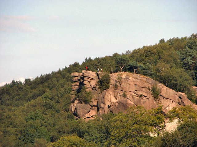
![]() This circular walk visits Black Rocks in the Peak District National Park. The rocks are a striking gritstone outcrop surrounded by the woodland of Cromford Moor. There are wonderful views of the Derwent Valley from the rocks which are in an elevated position above the town of Cromford.
This circular walk visits Black Rocks in the Peak District National Park. The rocks are a striking gritstone outcrop surrounded by the woodland of Cromford Moor. There are wonderful views of the Derwent Valley from the rocks which are in an elevated position above the town of Cromford.
The walk starts by the Cromford Canal and follows the High Peak Trail to Black Rocks. You then head across Cromford Moor with its woodland trails and heather moorland.
If you'd like to continue your walking in the area you could enjoy a waterside walk along the Cromford Canal. You could also head west along the High Peak Trail to visit Middleton Top. Here you'll find an excellent visitor centre with good facilities and a wealth of information on the area. There's also the historic Middleton Top Engine House, built in 1829 and fabulous views down to the nearby Carsington Water.
Black Rocks Cromford Ordnance Survey Map  - view and print off detailed OS map
Black Rocks Cromford Open Street Map  - view and print off detailed map
*New* - Walks and Cycle Routes Near Me Map - Waymarked Routes and Mountain Bike Trails>>
Black Rocks Cromford OS Map  - Mobile GPS OS Map with Location tracking
Black Rocks Cromford Open Street Map  - Mobile GPS Map with Location tracking
Pubs/Cafes
Head into the village and visit the excellent Wheatcroft’s Wharf at Cromford Mills for some lovely canalside refreshments. There's several tables right next to the water making it the ideal spot to relax on a fine day. They have a good menu with fresh ‘made to order’ food from oven baked potatoes to homemade soup, Paninis, Pizza, summer salads or a simple sandwich.
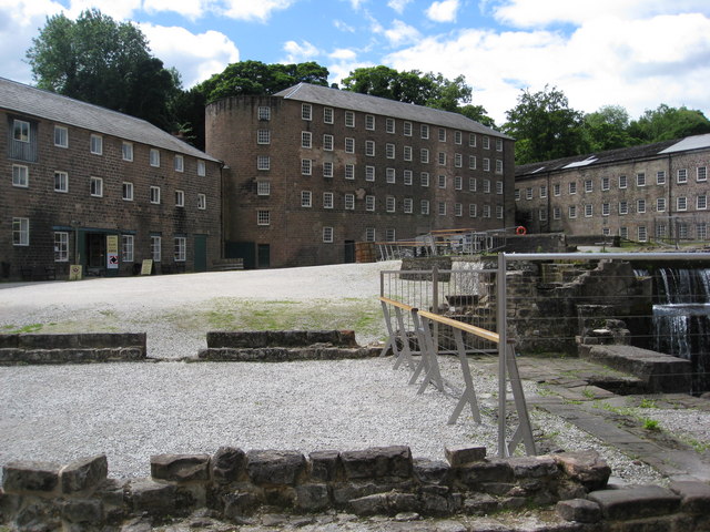
The site is also worth spending some time at with a wealth of information on this area. Cromford Mill is the home of Sir Richard Arkwright’s first mill complex, birthplace of the modern factory system and internationally recognised as a UNESCO World Heritage Site. Inside the centre there's interactive displays, games and puzzles that tell the story of how the valley changed the world in the 18th Century with the growth of the British cotton industry and its global impact. You can find the site at a postcode of DE4 3RQ for your sat navs.


Pictured above the Arkwirght Mill and the cafe at Cromford Mills.
Cycle Routes and Walking Routes Nearby
Photos
Blue sky, green field on Bolehill. From a bridleway off Oakerthorpe Road.Dry stone walls and a small copse. The farmer's vehicle is a Daihatsu Sport-Trak, a small 4*4 from the 1990s. An excellent vehicle in the snow and mud and economical to run, from an era before the owners of ridiculously over-sized "Chelsea Tractors" were scorned for their gas-guzzling and polluting habits. There is also a telecommunications mast at the top of the hill.
Elevation Profile


