Middleton Top and Harboro Rocks Circular Walk
![]()
![]() At Middleton Top you will find an excellent visitor centre with a number of good walking trails to try. The site includes the Middleton Top Engine House which you can visit on certain weekends throughout the year. Built in 1829 it was used to haul wagons up the Middleton incline and has been recently restored.
At Middleton Top you will find an excellent visitor centre with a number of good walking trails to try. The site includes the Middleton Top Engine House which you can visit on certain weekends throughout the year. Built in 1829 it was used to haul wagons up the Middleton incline and has been recently restored.
This circular walk takes you west from the centre to Harboro Rocks, before returning via Griffe Grange and Middleton Moor. The route makes use of some of the popular waymarked trails which run through the area.
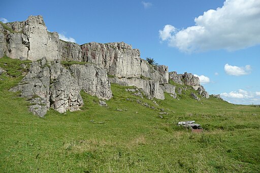
Starting from the centre car park you head west along the High Peak Trail. The shared walking and cycle path follows a disused railway line from Cromford to Dowlow. This section will take past Eniscloud Farm to Harboro Rocks. There's super views from here over the Peak District and the lovely Carsington Water.
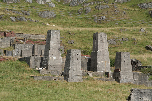
Just after passing the rocks you turn north east to pick up a section of the Limestone Way. A footpath then turns south east to take you through Griffe Grange before passing the quarries on Middleton Moor. The route then turns south to return you to the visitor centre and the finish point of the walk.
Another good walk to try from the centre is the hike to the Cromford Black Rocks.
Follow the High Peak trail a short distance to the east and you will soon come to the site. Here you will find striking gritstone outcrop surrounded by the woodland of Cromford Moor. There are wonderful views of the Derwent Valley from the rocks which are in an elevated position above the town of Cromford.
Postcode
DE4 4LS - Please note: Postcode may be approximate for some rural locationsMiddleton Top Ordnance Survey Map  - view and print off detailed OS map
Middleton Top Open Street Map  - view and print off detailed map
*New* - Walks and Cycle Routes Near Me Map - Waymarked Routes and Mountain Bike Trails>>
Middleton Top OS Map  - Mobile GPS OS Map with Location tracking
Middleton Top Open Street Map  - Mobile GPS Map with Location tracking
Pubs/Cafes
There's a cafe and shop next to the visitor centre where you can pick up sandwiches and drinks.
One nice idea is to stroll down into Wirksworth and enjoy some refreshments at The Blacks Head. They have a good menu and a lovely sun trap garden area for warmer days. It's cosy indoors with log burners during the chilly months. You can find them on the Market Place at postcode DE4 4ET for your sat navs.
Further Information and Other Local Ideas
The circular Brassington Walk starts from the nearby village and visits the site before heading to Carsington Water. The historic village is well worth a visit, with several centuries old limestone cottages, a church dating from the Norman period and a notable Tudor house built in 1615. There's also a fine 17th century inn with oak beams from the ships of the Spanish Armada.
You can follow the High Peak Trail on to Minninglow where you will find a fine hill climb and some significant ancient tombs.
For more walking ideas in the area see the Peak District Walks page.
Cycle Routes and Walking Routes Nearby
Photos
Middleton Top engine house. This engine house is situated at the top of the Middleton incline and is the only one remaining of nine which were originally located at the top of every incline on the Cromford and High Peak Railway. It houses a Butterley beam engine which was used to haul waggons up the incline. The engine still operates one weekend a month during the summer using compressed air instead of the timber that was originally used to fire the boilers.
Viewpoint Indicator. Detailed closeup of plaque. It shows all the places of interest that you can see on a fine day from Middleton Top.
Footpath crossing, Griffe Grange. The footpath from which the photograph was taken, leads back to the High Peak Trail at Hopton Top.


