Bow Brickhill Woods Walk
![]()
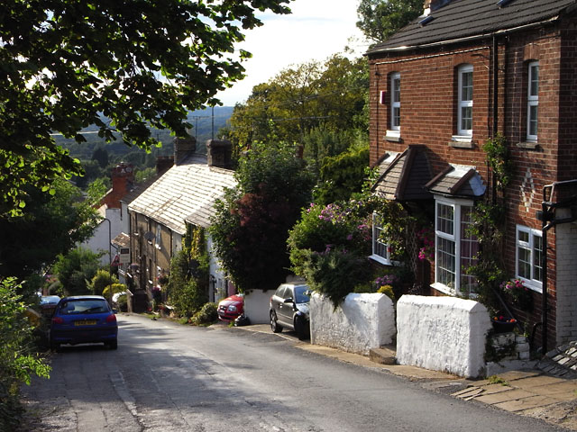
![]() This walk explores the woodland to the east of the village of Bow Brickhill in the Borough of Milton Keynes.
This walk explores the woodland to the east of the village of Bow Brickhill in the Borough of Milton Keynes.
The circular walk starts in the village and follows footpaths east to Brown's Wood and Wavendon Wood. There's miles of peaceful trails with the option of extending the walk into the adjacent Aspley Woods. You can also pick up the Milton Keynes Boundary Walk and use the waymarked long distance trail to further explore the area.
Just to the north west you'll find some pleasant waterside walking and cycling trails around Caldecotte Lake.
In the village you'll also find a noteworthy 12th century church and a train station on the Marston Vale Line that links Bletchley and Bedford.
Postcode
MK17 9JU - Please note: Postcode may be approximate for some rural locationsBow Brickhill Ordnance Survey Map  - view and print off detailed OS map
Bow Brickhill Open Street Map  - view and print off detailed map
Bow Brickhill OS Map  - Mobile GPS OS Map with Location tracking
Bow Brickhill Open Street Map  - Mobile GPS Map with Location tracking
Walks near Bow Brickhill
- Aspley Woods - These 800 acre woods near Milton Keynes have some good mountain bike trails and miles of footpaths.
- Milton Keynes Boundary Walk - Enjoy rivers, canals, woodland and beautiful countryside on this walk around the boundary of Milton Keynes
- Woburn Park - This walk takes you through the beautiful Woburn Park in Befordshire
- Greensand Ridge Walk - A walk through Bedforshire, Buckinghamshire and Cambridgeshire from Leighton Buzzard to Gamlingay
- Caldecotte Lake - Enjoy and easy cycle or walk around this pretty lake in Milton Keynes
- Woburn Sands - This Bedfordshire based town is located just to the east of Milton Keynes
- Rushmere Country Park - Explore 400 acres of lakes, ancient woodland conifer plantations, meadows and heath in this country park in Leighton Buzzard
- Toddington - This Bedfordshire based village sits on a major long distance trail and is surrounded by some lovely Chilterns countryside
- Milton Keynes - This long circular walk around Milton Keynes takes visits Caldecotte Lake, the River Ouzel, the Grand Union Canal, and Willen Lake
- Ascott House - This National Trust owned estate is the countryside residence of the Rothschild family
- Mentmore - This pretty village is located near Leighton Buzzard in Buckinghamshire
- Newport Pagnell - This Buckinghamshire based town is located on the eastern side of Milton Keynes
Pubs/Cafes
Back in the village you can enjoy some refreshment at The Wheatsheaf bar and grill. They serve a fine Sunday lunch and also have some outdoor seating if the weather is good. You can find them at 21 Station Road, MK17 9JU.
Dog Walking
The woodland trails make for a fine dog walk and the Wheatsheaf mentioned above is also dog friendly.
Further Information and Other Local Ideas
On the eastern side of Milton Keynes there's Newport Pagnell to explore. There's some lovely riverside trails, a fine local park and several historic buildings to see in this nearby town. The town is well known for being the original home of the exclusive sports car manufacturer Aston Martin. There's also a Grade I listed iron bridge dating from the early 19th century to see here.
Just to the west you'll find Bletchley Park and its fascinating museum. This historic site is world famous as the location of the crucial Allied code-breaking during World War II. The park is also a nice place for a stroll with some pleasant gardens and an ornamental lake.
Photos
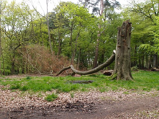
Public Bridleway. The view southwards into Browns Wood along the bridleway that joins up with the Milton Keynes Boundary Walk.


