Bradwell on Sea and Dengie Peninsula Walks
![]()
![]() This small village is located on the Dengie peninsula in Essex. There's some good trails along the Blackwater Estuary and a significant holy site to visit in the area.
This small village is located on the Dengie peninsula in Essex. There's some good trails along the Blackwater Estuary and a significant holy site to visit in the area.
This circular walk from the village takes you to the historic Chapel of St Peter on the Wall before following the coast path round to Bradwell Waterside.
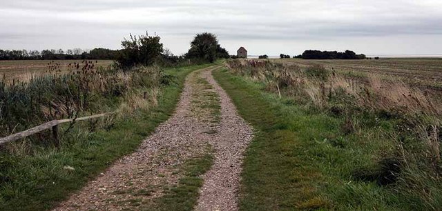
The walk starts in the village and then follows the Roman Road east to visit the Chapel of St Peter on the Wall. The 7th century chapel is Grade I listed and among the oldest largely intact Christian churches in England. The chapel also marks the start/end of the long distance St Peters Way footpath. The trail could be followed south and then east to visit Tillingham.
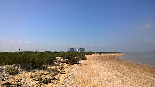
This route then heads north to Sales Point before passing west along the River Blackwater to Bradwell Waterside village, passing Bradwell Nuclear Power Station on the way. Here you head south along Bradwell Creek before passing the marina opposite Pewet Island. At Orplands you turn east to return to the village.
Postcode
CM0 7QL - Please note: Postcode may be approximate for some rural locationsBradwell on Sea Ordnance Survey Map  - view and print off detailed OS map
Bradwell on Sea Open Street Map  - view and print off detailed map
Bradwell on Sea OS Map  - Mobile GPS OS Map with Location tracking
Bradwell on Sea Open Street Map  - Mobile GPS Map with Location tracking
Pubs/Cafes
Back in the village there's the The King's Head for some post walk refreshment. The historic inn dates back to medieval times with additions during the Victorian times. The splendidly restored pub has a charming interior with an inglenook fireplace and log burning stove. There's also a conservatory and a nice garden area for warmer days. You can find them on the High Street with a postcode of CM0 7QL for your sat navs.
At Bradwell Waterside there's also the noteworthy Green Man. The historic 16th Century Freehouse is located in a fine spot near the river. You can find them at postcode CM0 7QX.
Dog Walking
The peninsula is a lovely place to bring your dog for a coastal walk. You'll probably see other owners as you make your way along the paths. Both pubs mentioned above are also very dog friendly.
Further Information and Other Local Ideas
If you head to the south side of the peninsula you could visit Burnham on Crouch and enjoy more waterside walks along the River Crouch. From Burnham quay, you can also catch a boat to view the seals which make their home at the mouth of the estuary.
On the opposite side of the estuary there's the villages of Tollesbury and Goldhanger to visit.
For more walking ideas in the area see the Essex Walks page.
Cycle Routes and Walking Routes Nearby
Photos
Coopers Beach. Coopers Beach caravan site with concrete sea defences. The twin blocks on the horizon is Bradwell Nuclear Power Station


