Blackwater Estuary
![]()
![]() Enjoy a walk along the lovely Blackwater Estuary from Maldon to Tollesbury. Flat footpaths run right along the river estuary with fine views and lots of wildlife to look out for on the way. The National Nature Reserve is home to little tern, ringed plover, Pied avocet, dunlin and Hen Harrier so be sure to bring your binoculars. The route runs for just over 13 miles with the option of catching the bus back to Maldon.
Enjoy a walk along the lovely Blackwater Estuary from Maldon to Tollesbury. Flat footpaths run right along the river estuary with fine views and lots of wildlife to look out for on the way. The National Nature Reserve is home to little tern, ringed plover, Pied avocet, dunlin and Hen Harrier so be sure to bring your binoculars. The route runs for just over 13 miles with the option of catching the bus back to Maldon.
The walk starts in the Essex town of Maldon, at the parking area next to the start of the Chelmer and Blackwater Navigation Canal. From here you can pick up a footpath heading east past the Heybridge Basin, Collier's Reach and Barrow Marsh. On this section you can enjoy fine views over to Northey Island. The island is home to a diverse range of birdlife and can be visited by arrangement with the warden.
You continue along Goldhanger Creek and Thirslet Creek before rounding the Tollesbury Wick Marshes. This nature reserve consists of coastal freshwater marsh which is grazed by sheep, and is worked by traditional methods which encourage wildlife. Areas of ungrazed rough pasture have badgers, and field voles and pygmy shrews are hunted by hen harriers and short-eared owls. After passing through the reserve the route finishes in the village of Tollesbury. The village is located at the mouth of the River Blackwater and has a nice pub where you can enjoy refreshments at the end of your exercise. You can then catch the bus back to Maldon.
To continue your walking along the estuary, head east to West Mersea and explore Mersea Island. Our route takes you along the coastline visiting beaches, Cudmore Grove Country Park and the settlements of West Mersea and East Mersea.
From Maldon you could start another walk from the Marine Lake in Promenade Park on the eastern side of the estuary. Footpaths here head south east along Southey Creek to Maylandsea with more fine views over the estuary.
Blackwater Estuary Ordnance Survey Map  - view and print off detailed OS map
Blackwater Estuary Open Street Map  - view and print off detailed map
Blackwater Estuary OS Map  - Mobile GPS OS Map with Location tracking
Blackwater Estuary Open Street Map  - Mobile GPS Map with Location tracking
Pubs/Cafes
You could stop off in the lovely village of Goldhanger and visit the Chequers Inn. The historic 14th century inn retains many of its original features and serves good quality traditional food. The attractive pub also includes a garden area to relax in on warmer days. You can find them at The Square, 1 Church St, CM9 8AS. Right next door you can investigate St Peter's Church which dates from the Norman period.
Further Information and Other Local Ideas
At the end of the route you can extend your exercise on the Tollesbury Walk. This fine circular walk explores the wonderful coastal nature reserve that surrounds the village.
On the opposite side of the estuary there's the village of Bradwell on Sea. Here you can pick up the epic St Peters Way footpath which starts from the 7th century chapel of St Peter on the Wall, just to the east of the village.
For more walking ideas in the area see the Essex Walks page.
Cycle Routes and Walking Routes Nearby
Photos
Tollesbury Wick Marshes. The site of Tollesbury Pier railway station. In 1907 the Kelvedon & Tollesbury Light Railway was extended to a new station at the landward end of a pier on Tollesbury Wick Marshes. The station consisted of an old railway carriage body and a small brick building. It lasted no more than 14 years before being abandoned. The development which it was hoped would follow the railway never happened and the marsh, still completely remote, is now a nature reserve. The tower seen in the far distance in the photo is a World War II lookout tower.
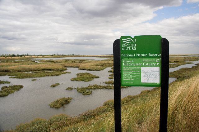
Sign marking start of Blackwater Estuary Nature Reserve. The Sign Reads: This National Nature Reserve consists of Old Hall Marshes and the mudflats of Tollesbury and Salcott which are used by internationally important numbers of wading wildfowl during the winter and on migration in spring an autumn.


