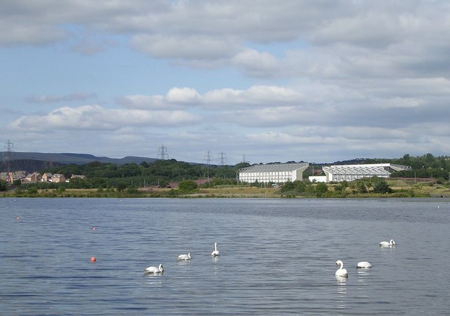
Broadwood Loch
![]()
![]() This pretty loch in Cumbernauld has a nice circular trail to follow around the perimeter.
This pretty loch in Cumbernauld has a nice circular trail to follow around the perimeter.
You can start the walk at the car park located at the south western end of the lake. Then follow the footpaths round the water for a distance of just under 2 miles.
There's nice views over the loch to the Campsie Fells in the distance. If you bring some bread with you then you can spend some time feeding the resident ducks and swans.
You can continue your walking around Cumbernauld by heading east to visit Palacerigg Country Park. There's some fine nature trails here with the picturesque Fannyside Lochs, ponds and rare breed animals to see as well.
Postcode
G68 9DY - Please note: Postcode may be approximate for some rural locationsBroadwood Loch Ordnance Survey Map  - view and print off detailed OS map
Broadwood Loch Open Street Map  - view and print off detailed map
Broadwood Loch OS Map  - Mobile GPS OS Map with Location tracking
Broadwood Loch Open Street Map  - Mobile GPS Map with Location tracking
Further Information and Other Local Ideas
To continue your exercise you could head pick up the Airdrie to Bathgate Cycle Path and visit Hillend Reservoir. Polkemmet Country Park, Roughrigg Reservoir and Forrestburn Reservoir are also not too far away.
To the north in Kilsyth there's Banton Loch on the Colzium Estate. The estate also includes the ruins of the 16th century castle, a visitor centre, a garden cafe and a walled garden.
Cycle Routes and Walking Routes Nearby
Photos
Freezing Fowl on the Loch. Sub zero temperatures with a very small part of water not frozen. This loch is not a natural one it was created by damming the Moss Water burn in the 1990s.


