Bruton River and Dovecote Walk
![]()
![]() This pleasant town in Somerset has some interesting features including a hill top 16th century Dovecote and a 15th century packhorse bridge over the River Brue, which runs through the town. For walkers there's river trails, a couple of waymarked footpaths and the nearby Stourhead Estate to explore.
This pleasant town in Somerset has some interesting features including a hill top 16th century Dovecote and a 15th century packhorse bridge over the River Brue, which runs through the town. For walkers there's river trails, a couple of waymarked footpaths and the nearby Stourhead Estate to explore.
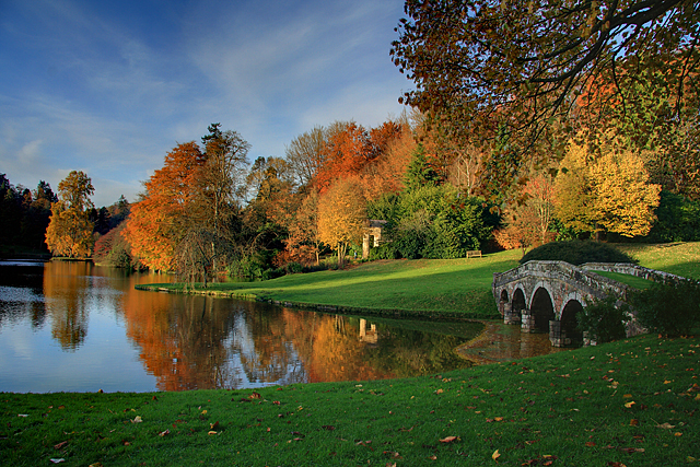
This walk from the town takes you east along the Leland Trail to visit King Alfred's Tower and the stunning gardens at Stourhead.
The walk starts on the River Brue in the town centre, just to the west of the train station and the remains of the Abbey. Here you pick up the Leland Trail and follow the waymarked footpath south through the town, passing the National Trust dovecote on the way. The route then heads out into the country, following paths south east to Discove and Redlynch. You then head due east until you reache a large woodland area where you turn north to climb to King Alfred's Tower. The Tower is named after King Alfred who raised his standard here in 870. The structure commemorates the accession of George III in 1760 and the end of the Severn Years War. You can climb the tower's 205 steps and admire the spectacular view of the three surrounding counties.
After enjoying the views you continue south east through the woods to pick up the Stour Valley Way and following it to Stourhead.
After exploring the parkland you head west through the woods to rejoin the Leland Trail. You can then follow this back to Bruton.
Bruton Ordnance Survey Map  - view and print off detailed OS map
Bruton Open Street Map  - view and print off detailed map
Bruton OS Map  - Mobile GPS OS Map with Location tracking
Bruton Open Street Map  - Mobile GPS Map with Location tracking
Pubs/Cafes
Back in the town the 13th century Sun Inn is a great choice for some post walk refreshment. They do delicious Persian food and have a lovely large beer garden to relax in on warmer days. You can find them on the High Street at postcode BA10 0AH for your sat navs.
Dog Walking
The country and woodland trails on the route make for a fine dog walk. You are asked to please keep them on a lead in the Stourhead Estate. The Sun Inn mentioned above is also dog friendly.
Further Information and Other Local Ideas
To continue your walking around Bruton you could follow the Leland Trail south west to visit Wyke Champflower, Ansford and Castle Cary. Here you can pick up the Castle Cary Walk which will take you south to the hill fort at Cadbury Castle along the epic Macmillan Way.
If you head east into the village you can pick up the Cranborne Chase Walks in the nearby AONB.
The Mere Walk starts from the nearby town and climbs to White Sheet Hill. The hill is part of the Stourhead Estate and includes an Iron Age Hillfort, an aerial transmitter and a small reservoir. There's also some lovely downland and excellent views over the area. The town itself is also worth visiting with a photogenic market square, the excellent viewpoint at Long Hill and a fine 16th century coaching inn for refreshment afterwards.
For more walking ideas in the area see the Somerset Walks pages.
Cycle Routes and Walking Routes Nearby
Photos
River Brue, Bruton. View down the river to the packhorse bridge. Bow Bridge dates from the 15th century. It has been designated as a Grade I listed building, and Scheduled Ancient Monument. The bridge may have been built as a link between the former Bruton Abbey, and its courthouse in the High Street.
Dovecote overlooking Bruton. A landmark overlooking the village. A curious stone building which is now owned by the National Trust. The limestone landmark was built between the 15th and 17th century. It was once used as a dovecote, and may have been a watchtower or prospect tower prior to this.
The coach road east of Redlynch. The coach road is believed to have been a driveway from Redlynch Mansion linking to the London coach road. Today it is a very pleasant footpath across gentle pasture land.
King Alfred's Tower at Stourhead. The owner of Stourhead estate, Henry Hoare II, dreamt up the idea for this grandiose 'folly' so that wide reaching views could be had from its top. It also marked the reputed site where King Alfred the Great rallied his troops before the battle of Ethandun.


