Mere Walks
![]()
![]() This delightful Wiltshire based town is a fine place to start a walk with miles of trails to explore the surrounding downland and farmland of the Cranborne Chase and West Wiltshire Downs Area of Outstanding Natural Beauty.
This delightful Wiltshire based town is a fine place to start a walk with miles of trails to explore the surrounding downland and farmland of the Cranborne Chase and West Wiltshire Downs Area of Outstanding Natural Beauty.
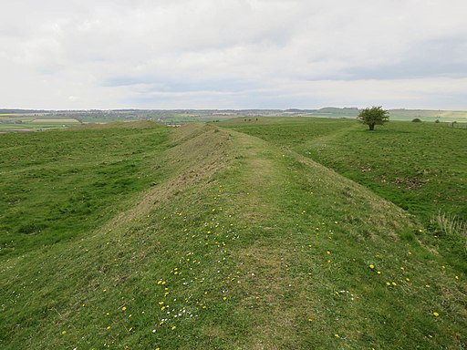
This walk from the town takes you north to climb to the viewpoint and hill fort on the nearby White Sheet Hill.
You start in the town centre and head a short distance north to climb to Long Hill. This fine viewpoint is located on the north eastern edge of the town. It's the site of an old 13th century castle and offers great views over the surrounding countryside from its elevated position above the settlement.
The route then follows the Mid-Wilts Way north, climbing to White Sheet Hill. Here you'll find the site of an Iron Age Hillfort, an aerial transmitter and a small reservoir. The hill and the surrounding attractive downland is owned by the National Trust and forms part of the wider Stourhead Estate. There are excellent views over the countryside of Somerset, Dorset and Wiltshire from the hill top.
After taking in the views the route descends on the same paths to Mere.
Postcode
BA12 6DR - Please note: Postcode may be approximate for some rural locationsMere Ordnance Survey Map  - view and print off detailed OS map
Mere Open Street Map  - view and print off detailed map
Mere OS Map  - Mobile GPS OS Map with Location tracking
Mere Open Street Map  - Mobile GPS Map with Location tracking
Walks near Mere
- Stourhead - The 1,072 hectare (2,650 acre) Stourhead estate has miles of lovely walking trails to try. You can follow the well surfaced footpaths around the stunning lake and into the surrounding woodlands, parkland and gardens
- Monarch's Way - This incredible 615-mile walk approximates the escape route taken by King Charles II in 1651 after being defeated in the Battle of Worcester
- Wincanton - This Somerset based town has some nice trails along the River Cale and a major national long distance footpath running through it
- Warminster - The Wiltshire based town of Warminster is in an ideal location for exploring the lovely Cranborne Chase AONB and the expansive Salisbury Plain
- Stour Valley Way - This splendid walk takes you along the River Stour from Hengistbury Head on the Dorset south coast to Stourton in Wiltshire
- Leland Trail - Follow in the footsteps of royal librarian John Leland during his 16th century survey of Britain's churches and priories.
You start at King Alfred's Tower at the north-western edge of the Stourhead in Wiltshire and head west towards Bruton and Castle Cary Walk in Somerset - Wylye Way - Follow the River Wylye through Wiltshire on this interesting and varied waterside walk
- Bruton - This pleasant town in Somerset has some interesting features including a hill top 16th century Dovecote and a 15th century packhorse bridge over the River Brue, which runs through the town
- Gillingham - Gillingham is notable as the most northerly town in the county of Dorset
- Mid-Wilts Way - A 68-mile walking route that takes in some of Wiltshire's finest countryside and downland areas
- Penselwood - This little village in Somerset has a noteworthy 15th century church and some nice country trails to try
Pubs/Cafes
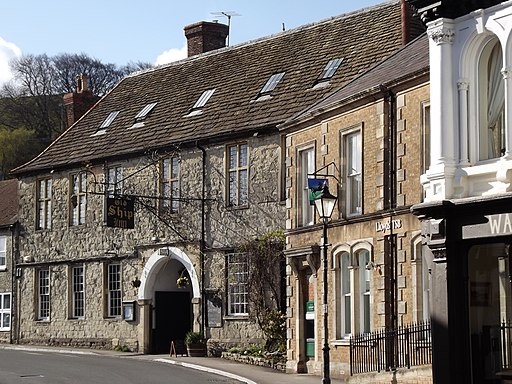
The George Inn is a nice place to enjoy some refreshment after your walk. The 16th century coaching inn has an interesting history with King Charles II visiting the inn on his way from Trent to Heale house whilst fleeing after his defeat at the Battle of Worcester in 1651. Inside there's a relaxed dining area and an impressive log fire. They serve good quality food and can be found on the attractive town Square at postcode BA12 6DR.
Dog Walking
The downland trails make for a fine dog walk and the George Inn mentioned above is also dog friendly.
Further Information and Other Local Ideas
Head west from the hill top and you could further explore the Stourhead Estate around Stourton. There's some lovely footpaths around the gardens and lake on the estate's extensive parkland. The Stour Valley Way long distance trail also starts at Stourton.
The Monarch's Way passes through the town. You could follow it west to visit neighbouring Wincanton or head east to visit the Mackintosh Davidson Wood Nature Reserve where there's lots of wildlife to see.
Just to the south is the pretty village of Compton Abbas where you can visit Fontmell and Melbury Downs, Compton Abbas Airfield and the highest point in the Cranborne Chase AONB at Win Green Hill.
For more walking ideas in the area see the Cranborne Chase Walks and Wiltshire Walks pages.
Photos
Mere tow centre view. Many buildings in the town date from the late 17th century and are constructed of local stone.


