Burpham Walks
![]()
![]() This charming Sussex based village has some nice thatched cottages, a Grade I listed Saxon Church and a century-old cricket pitch where W. G. Grace played.
This charming Sussex based village has some nice thatched cottages, a Grade I listed Saxon Church and a century-old cricket pitch where W. G. Grace played.
The ancient settlement also has a rich literary history. Mervyn Peake and his family lived here and he walked the South Downs while devising the fantasy characters of Gormenghast.
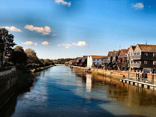
This circular walk from the village visits neighbouring Arundel, North Stoke and Amberley. On the way you'll enjoy long riverside stretches along the River Arun.
Highlights on the way include the historic Arundel Castle, Arundel Cathedral and Arundel Priory. The castle includes beautiful gardens, exquisite furniture, tapestries and a rare collection of paintings, though there is a fee for entry to the grounds. It also has a fascinating history dating back to 1067 and some of the original features such as the Norman Keep, medieval Gatehouse and Barbican survive today.
Part of the walk uses a section of the epic Monarch's Way while you can also pick up The South Downs Way National Trail just north of the settlement near Amberley.
Burpham Ordnance Survey Map  - view and print off detailed OS map
Burpham Open Street Map  - view and print off detailed map
Burpham OS Map  - Mobile GPS OS Map with Location tracking
Burpham Open Street Map  - Mobile GPS Map with Location tracking
Walks near Burpham
- Arundel Castle and Arundel Park - This circular walk takes you through the parkland and countryside surrounding this restored medieval castle in West Sussex
- Arundel to Littlehampton River Walk - Enjoy a waterside walk along the River Arun from Arundel to Littlehampton on this easy route in West Sussex
- Amberley to Arundel - A popular riverside walk along the River Arun from Amberley to Arundel
- Slindon Estate - The Slindon Estate is a fantastic place for walkers and cyclists with miles of footpaths and bridleways to follow through the 1400 hectare estate
- Angmering Park Estate Woods - The expansive area of woodland surrounding the Angmering Park Estate has miles of public bridleways and footpaths for walkers and cyclists to try.
- Eartham Woods - This large area of beech woodland near Slindon has some nice footpaths to follow
- Monarch's Way - This incredible 615-mile walk approximates the escape route taken by King Charles II in 1651 after being defeated in the Battle of Worcester
- The South Downs Way - This beautiful 100 mile long trail runs from Winchester to the coastal town of Eastbourne
- Amberley Circular Walk - The delightful village of Amberley is located at the foot of the South Downs, in the Horsham District of West Sussex
- Rackham Woods - This circular walk explores Rackham Woods on the South Downs, in the Horsham District of West Sussex.
- Littlehampton - This West Sussex based town is a fine place for walkers with coastal trails, riverside paths, a picturesque harbour and two beautiful award winning beaches
Pubs/Cafes
You could stop for refreshments at The George which dates from 1736. Here you'll find modern, seasonal cooking and local real ales in a smartly made-over, friendly village inn. You can find them on the Main Street at postcode BN18 9RR for your sat navs.
Dog Walking
The river and country trails make for a fine dog walk and the George mentioned above is also dog friendly
Further Information and Other Local Ideas
For more walking ideas in the area see the South Downs Walks page.


