Around Littlehampton - Coastal Circular Walk
![]()
![]() This West Sussex based town is a fine place for walkers with coastal trails, riverside paths, a picturesque harbour and two beautiful award winning beaches.
This West Sussex based town is a fine place for walkers with coastal trails, riverside paths, a picturesque harbour and two beautiful award winning beaches.
This circular walk from the town takes you along the coastal path to nearby Atherington before returning through inland footpaths by the golf course.
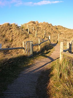
The walk starts in the town next to the train station where you can cross the River Arun on the Arun Footbridge. Head south along Rope Walk and you can then pick up a nice footpath along the Arun running down to the sea front at West Pier. On the way you will pass the old Littlehampton fort, built to guard the mouth of the Arun. Head west along the beach and the dunes and you will soon come to Atherington. There's another nice beach here and good facilites with a cafe and car park.
From Atherington head north and then east to follow footpaths along the golf course. These will lead you back towards the river and the train station. On the way you will pass the picturesque Climping Mill.
To continue your walking around Littlehampton pick up the Arundel to Littlehampton River Walk and head north along the river to visit the splendid Arundel Castle and Arundel Park. Continuing west along the coastal path will take you to the popular resort of Bognor Regis. Heading east will take you into the larger town of Worthing where you can visit Bramber Castle and the ancient Cissbury Ring.
Littlehampton Ordnance Survey Map  - view and print off detailed OS map
Littlehampton Open Street Map  - view and print off detailed map
Littlehampton OS Map  - Mobile GPS OS Map with Location tracking
Littlehampton Open Street Map  - Mobile GPS Map with Location tracking
Walks near Littlehampton
- Arundel to Littlehampton River Walk - Enjoy a waterside walk along the River Arun from Arundel to Littlehampton on this easy route in West Sussex
- Arundel Castle and Arundel Park - This circular walk takes you through the parkland and countryside surrounding this restored medieval castle in West Sussex
- Highdown Hill and Highdown Gardens - This walk visits Highdown Gardens before climbing Highdown Hill in the South Downs
- Angmering Park Estate Woods - The expansive area of woodland surrounding the Angmering Park Estate has miles of public bridleways and footpaths for walkers and cyclists to try.
- Worthing - This circular walk explores the South Downs to the north of this West Sussex seaside town
- Bognor Regis - This popular seaside resort sits in a lovely spot on the West Sussex coast
- Burpham - This charming Sussex based village has some nice thatched cottages, a Grade I listed Saxon Church and a century-old cricket pitch where W
- Pagham Harbour - Enjoy a walk around this lovely coastal nature reserve and look out for thousands of wading birds
- Slindon Estate - The Slindon Estate is a fantastic place for walkers and cyclists with miles of footpaths and bridleways to follow through the 1400 hectare estate
- Burpham - This charming Sussex based village has some nice thatched cottages, a Grade I listed Saxon Church and a century-old cricket pitch where W
- River Adur and Bramber Castle - Follow a waterside path along the River Adur to Bramber Castle on this walk in West Sussex
- Cissbury Ring - Visit this historic hill fort in West Sussex and enjoy terrific views over the South Downs countryside on this circular walk
- Amberley Circular Walk - The delightful village of Amberley is located at the foot of the South Downs, in the Horsham District of West Sussex
Pubs/Cafes
Head to the Arun View for some rest and refreshment after your exercise. The riverside pub sits in a fine location overlooking the Arun. You can sit outside on the lovely patio and enjoy some delicious sea food with a view. The pub can be found at Wharf Road with postcode BN17 5DD for your sat navs.
There's also the noteworthy East Beach Cafe to consider. This striking piece of architecture resembles a giant piece of driftwood. You can enjoy some delicious seafood here. You can find them on the Promenade at postcode BN17 JG.
Dog Walking
The beach and river trails make for a fine dog walk. The Arun View mentioned above is also dog friendly.
Photos
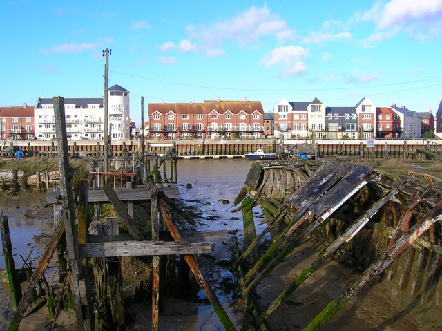
Old Quay Wharf. On the eastern bank of the Arun and the oldest known site of a harbour in Littlehampton, being the town's quay from the 17th century. Now largely redeveloped and viewed from The Harbour on the western bank where the rotting hulks of abandoned vessels juxtapose nicely the old and the new.
Littlehampton Fort Built in 1854 at the same time as the one along the coast at Shoreham to guard the mouth of the Arun. Decommissioned in 1873 parts were dismantled in 1900 and the barracks followed in 1960. The fort is also gives a good indicator of how the dunes have spread in the last 150 years as it originally had a clear view of fire out to sea when constructed. Now overgrown with vegetation and off limits to the public as it falls within the fenced off area of the West Beach Nature Reserve.
Littlehampton Marina. Highlights the changing face of the river, much use now being put over to leisure and residential whilst the industrial side is limited to two quays on the eastern bank. The sleet shower is heading out into the channel whilst the sun is shining on the marina causing a rainbow to brighten up Littlehampton.
Littlehampton Golf Club. Laid out in 1889 and one of the few links courses in Sussex. Originally the land was part of the Arun estuary but silted up during the early modern period with a sand spit deflecting the river east until the present day mouth was cut in the late 18th century. On the horizon are the sand dunes that separate the course from the beach. The clubhouse was rebuilt in 1985 to replace the original which was destroyed by fire.


