Croydon Walks
![]()
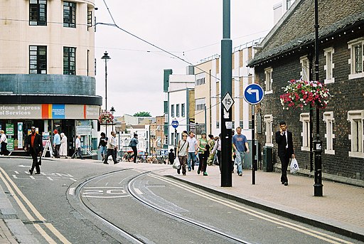
![]() This south London town has several nearby countryside trails, woodland areas, hill climbs, country parks and nature reserves to visit on foot. The town has good transport links being at the centre of the only tramway system in southern England. It's also well known for the Whitgift Centre, one of the largest shopping centres in the country with a monthly footfall of 2.08 million.
This south London town has several nearby countryside trails, woodland areas, hill climbs, country parks and nature reserves to visit on foot. The town has good transport links being at the centre of the only tramway system in southern England. It's also well known for the Whitgift Centre, one of the largest shopping centres in the country with a monthly footfall of 2.08 million.
This circular walk from the town visits some of the walking highlights of the area including Addington Hills, Selsdon Wood and Croham Hurst. The route makes use of the waymarked London Loop which runs through the area.
The walk starts from the train station in the town centre. From here head east to pick up the London Loop which you can follow up to Addington Hill. This section passes Lloyd Park and Coombe Park where there are some nice trails to try. There's a good viewpoint in the Addington Hills where you can enjoy views over the town to some of the landmarks in the city of London.
The route then heads south through Heathfield and Little Heath Woods before coming to Selsdon Wood.
After exploring the woods you then retrace your steps to Littleheath Woods where you can follow an alternative path north west to visit Croham Hurst.
From the woods it is a short walk back into the town centre to the train station where the route finishes.
Croydon Ordnance Survey Map  - view and print off detailed OS map
Croydon Open Street Map  - view and print off detailed map
Croydon OS Map  - Mobile GPS OS Map with Location tracking
Croydon Open Street Map  - Mobile GPS Map with Location tracking
Walks near Croydon
- Addington Hills - Climb to this viewpoint in Croydon and enjoy great views across the City of London and the North Downs
- Selsdon Wood - This woodland and nature reserve in Croydon is criss crossed with a number of nice footpaths and walking trails
- Croham Hurst - Explore these geologically significant ancient woods on this short walk in Croydon
- South Norwood Country Park - A cycle or walk through this pleasant country park in Croydon
- Wandle Trail - Follow the River Wandle from the River Thames at Wandsworth to Croydon
- Vanguard Way - This 66 mile trail runs from the outskirts of London, through Ashdown Forest, Alfriston and Cuckmere Valley to the stunning East Sussex coast.
Route highlights include the lovely Ashdown Forest, the White Horse near Alfriston and the wonderful final coastal stretch that gives views of the Seven Sisters Cliffs and Tidemills beach - Mitcham Common - Explore this large area of common land on this easy circular walk in south London
- Beddington Park - This park near Carshalton has good footpaths to follow along the River Wandle and around the pretty lake
- Clopton Way - This walk runs from Wimpole Hall to Gamlingay via the abandoned medieval village of Clopton
- Beckenham Place Park - This circular walk explores Beckenham Place Park in the London Borough of Lewisham
- Keston Common - This area of common land in Bromley covers 55 hectares and includes some nice footpaths
- London Loop - Also known as the London Outer Orbital Path, this walk takes you on a tour of the parks, woods and fields around the edge of Outer London
- Riddlesdown Common - This walk visits a pleasant green space in the Purley area of the London Borough of Croydon.
Pubs/Cafes
Back in the town The Spread Eagle is a good choice for some post walk refreshment. The Victorian pub is particularly well known for its excellent pies and also has an outdoor seating area if the weather is fine. You can find them at 39-41 Katharine Street with postcode CR0 1NX for your sat navs.
Dog Walking
The woodland and parkland on the route make for a fine dog walk and the Spread Eagle mentioned above is also dog friendly.
Further Information and Other Local Ideas
Just to the north is the popular South Norwood Country Park where there are more good walking and cycling trails to pick up.
For more walking ideas in the area see the London Walks page.
Photos
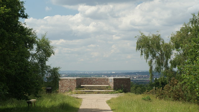
Addington Hills viewpoint. In this view we are looking to the north-west, and the distant hills are at least 20 miles away. The viewpoint gives views through a 90 degree arc from the Millennium Dome (O2 Arena) near Greenwich to the offices of Central Croydon.
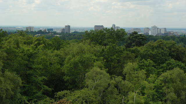
Another view From Addington Hills. Looking towards the offices of South Croydon to the left of picture, and Central Croydon to the right of picture. This series of 7 pictures was taken from the viewpoint on the top of Addington Hills. 50 years ago, this area seemed better known as Shirley Hills. The viewpoint is a short walk from the car park, which also serves as a Chinese restaurant.
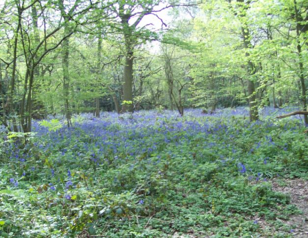
Littleheath Woods, Selsdon. 64 acres of woodland with footpaths, bridle path and children's playground, Littleheath Woods is now a collective name for a number of woods which over the past 100 years have grown together, with a field on the north eastern side. The photo shows Littleheath Wood itself, across Clears Croft, from just inside the Brent Road entrance.


