Dewsbury Country Park Walks
![]()
![]() This walk visits Dewsbury Country Park in the market town of Dewsbury, Kirklees.
This walk visits Dewsbury Country Park in the market town of Dewsbury, Kirklees.
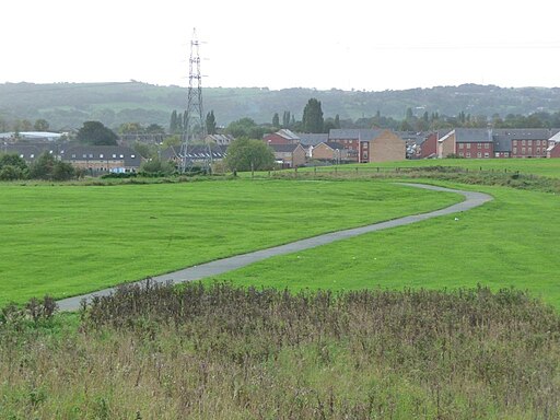
You can find the park to the west of the town centre on the former Lower Spen Valley Landfill site between Ravensthorpe, Dewsbury Moor and Heckmondwike. There's miles of footpaths with orchards, wildflower meadows, ponds and lots of wildlife to see. Keep your eyes peeled for a variety of birds and butterflies around the wildflowers in the summer months.
You can start your walk from the car park and then pick up a trail along the Spen Beck before crossing the waterway and exploring the other part of the park.
The Spen Valley Greenway runs through the park providing an opportunity to extend your walk. The shared cycling and walking route runs along a disused railway line from Dewsbury to Oakenshaw near Bradford.
If you head east you could visit Crow's Nest Park where there's an ornamental lake and a a walled wildflower garden to see.
On the eastern side of the town you could also pick up the Kirklees Way. The long distance, waymarked trail explores the Kirklees district visiting the Colne Valley, Spen Valley and Holme Valley.
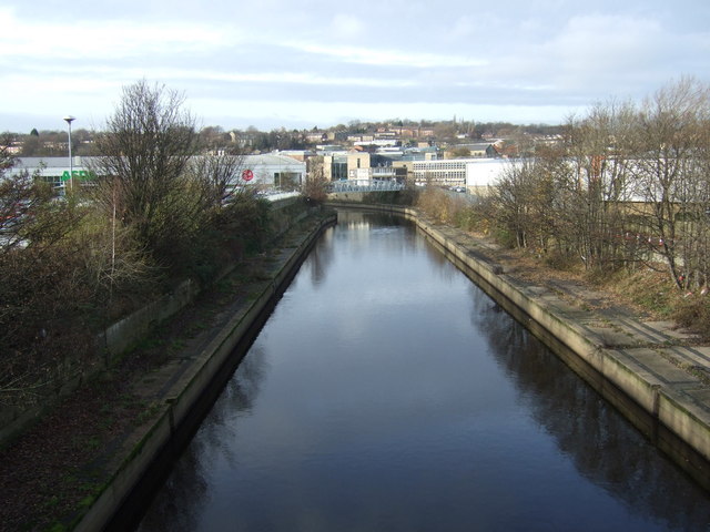
On the southern side of the town you can pick up the Calder and Hebble Navigation Canal at the Dewsbury Canal Basin.
Postcode
WF13 3TH - Please note: Postcode may be approximate for some rural locationsDewsbury Country Park Ordnance Survey Map  - view and print off detailed OS map
Dewsbury Country Park Open Street Map  - view and print off detailed map
Dewsbury Country Park OS Map  - Mobile GPS OS Map with Location tracking
Dewsbury Country Park Open Street Map  - Mobile GPS Map with Location tracking
Walks near Dewsbury
- Spen Valley Greenway - This splendid cycling and walking route runs along a disused railway line from Dewsbury to Oakenshaw near Bradford
- Kirklees Way - Explore the Kirklees metropolitan district on this challenging circular walk through West Yorkshire
- Bretton Country Park - This country park includes 500 acres of lakes and parkland, housing various sculptures as well as being the home of several endangered species
- Cannon Hall Country Park - Explore the beautiful lansdscaped gardens of Cannon Hall in Cawthorne, Yorkshire
- Deffer Wood - This circular walk visits Deffer Wood in West Yorkshire
- Emley Circular Trail - This circular walk explores the area around the historic village of Emley in Kirklees.
- Coxley Woods - These woods near Netherton have miles of trails to follow through attractive woodland
- Calder Valley Greenway - This route runs from Huddersfield to Dewsbury along the Calder Valley Greenway
- Huddersfield Broad Canal - Enjoy an easy stroll along the towpath of the Huddersfield Broad Canal on this walk in Huddersfield
- Calder and Hebble Navigation Canal - This section of the Calder and Hebble Navigation Canal runs along National Cycle Route 66 from Sowerby Bridge to Brighouse
- Brighouse Boundary Walk - A circular walk exploring the area around the town of Brighouse in West Yorkshire
Pubs/Cafes
The Ravenswharfe Hotel is located just to the south of the park and a nice place to relax after your walk. The friendly pub has a nice outdoor patio area and can be found at Huddersfield Rd, WF13 3EH.
Dog Walking
The park is a good place to walk the dog and the pub mentioned above is also dog friendly.
Photos
Lake Crow's Next Park. Opened to the public in 1893, the park originated on the grounds on a country house estate dating from the 16th century. It was created to bring a feel of the countryside into what was a heavily industrial area. Attractions include an adventure playground, an ornamental lake, formal lawns, a walled wildflower garden, sports facilities, a greenhouse and a café.


