Dinas Head Walk
![]()
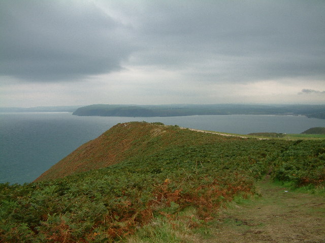
![]() Enjoy stunning coastal views on this circular walk on the Pembrokeshire Coast. Dinas Island is actually a peninsula with a wonderful 466ft (142m) viewpoint at the high point known as Pen-y-fan. It's a steep climb but you are rewarded with wonderful views of Cardigan Bay, Fishguard Bay, Snowdonia and the Llyn Peninsula.
Enjoy stunning coastal views on this circular walk on the Pembrokeshire Coast. Dinas Island is actually a peninsula with a wonderful 466ft (142m) viewpoint at the high point known as Pen-y-fan. It's a steep climb but you are rewarded with wonderful views of Cardigan Bay, Fishguard Bay, Snowdonia and the Llyn Peninsula.
The headland itself is very attractive, covered with a variety of plants and flowers including gorse, bracken, hawthorn, blackthorn, heather, foxglove and orchids. There's also good birdwatching opportunities as you may see choughs, peregrine falcons and various other sea birds.
The walk starts at the car park at Cwm Yr Eglwys at the south eastern end of Dinas Island. You then follow the Pembrokeshire Coast Path to Pen-y-fan passing the Old Sailor Pub on the way.
You can also reach Dinas Island by following the Pembrokeshire Coast Path from nearby Fishguard.
To extend your walking in the area head south and visit the delightful Gwaun Valley. The peaceful valley has lovely riverside footpaths and attractive woodland to enjoy.
Postcode
SA42 0SE - Please note: Postcode may be approximate for some rural locationsDinas Head Ordnance Survey Map  - view and print off detailed OS map
Dinas Head Open Street Map  - view and print off detailed map
Dinas Head OS Map  - Mobile GPS OS Map with Location tracking
Dinas Head Open Street Map  - Mobile GPS Map with Location tracking
Pubs/Cafes
Head into the 16th century Old Sailors for some well earned refreshments after your walk. The friendly pub is located on the western side of the headland at Pwllgwaelod Beach. It's a fabulous spot with a garden area with fine views of the boats leaving Fishguard Harbour. There's a good sized car park and direct access to the beach if you fancy a bit of sunbathing. You can find the pub at Dinas Cross with a postcode of SA42 0SE for your sat navs.
Dog Walking
The bracing headland is a great place for a dog walk. The Old Sailors pub mentioned above is also dog friendly with dogs welcome in the garden area and on the beach.
Further Information and Other Local Ideas
Head west of Fishguard and you can visit Strumble Head. There's a fine circular walk visiting the lighthouse with the prospect of seeing porpoises and seals in the seas below.
To the east there's the delightful town of Newport. The picturesque settlement is well worth visiting with its sandy beach, excellent variety of shops and cafes, and some fine trails along the River Nevern Estuary.
Head south east and you can try the climb to Carn Ingli in the Preseli Hills. It's a worthy climb with a number of fascinating ancient sites dating from the Iron Age and the Bronze Age. There's also some glorious views to the coast from the summit.
Cycle Routes and Walking Routes Nearby
Photos
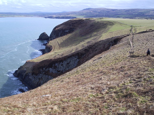
Above Pwll Glas on Dinas Head. Very little land in this gridsquare: the path between Pen Dinas and Cwm yr Eglwys just brushes the southwest corner. The deeply indented bay below is Pwll Glas/Blue Pool - or Green, as in Welsh one word covers a wider area of the spectrum. Needle Rock can be seen further east with Newport and Carn Ingli in the distance.


