Dover to Deal Coastal Walk with OS Map
![]()
![]() This coastal walk takes you from the famous port of Dover to the attractive town of Deal. It's about a 9.5 mile walk with the option of returning to Dover on the train. There's great cliff top views, a series of historic castles and a long stretch of lovely countryside with wildflowers and butterflies.
This coastal walk takes you from the famous port of Dover to the attractive town of Deal. It's about a 9.5 mile walk with the option of returning to Dover on the train. There's great cliff top views, a series of historic castles and a long stretch of lovely countryside with wildflowers and butterflies.
The walk starts by the marina in Dover and heads towards the wonderful Dover Castle. It's the largest castle in England and includes the fascinating Secret Wartime Tunnels and interesting exhibitions.
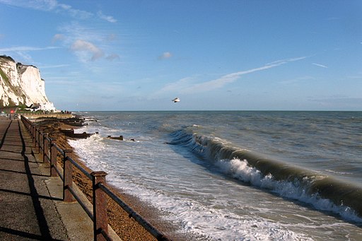
You climb past the castle and through the National Trust owned White Cliffs Country Park. There's a nice visitor centre here with information about the different trails you can try in the park. From the viewpoints there are great views of the famous Dover White Cliffs and the Dover Docks.
After passing through the park you continue east to the Victorian South Foreland Lighthouse. You can climb to the top of the structure and enjoy great views over to France. There's also a nice cliff top cafe which is a great place to stop for refreshments.
The route continues to St Margaret's Bay passing the delightful Pines Garden. The gardens include a waterfall, lake, a grass labyrinth and an organic kitchen garden with around 40 different species of fruit and vegetables. The site also includes the St. Margaret's Museum with interesting local history displays such as St Margaret's during WW2, and one-time resident Noel Coward.
The route then descends to Kingsdown, passing along the beach and the golf course. Shortly after you come to the very fine Walmer Castle. It was built during the reign of King Henry VIII and includes lovely 8 acre gardens and fascinating exhibitions.
The final section takes you into Deal, where you can enjoy a stroll along the pier. From here it is a short walk to the train station where you can return to Dover.
There's great scope for extending your walk by following the White Cliffs Country Trails from Deal to Sandwich. Here there are nice views of the River Stour and lots of nice pubs to choose from.
To head along the coast in the other direction try our Dover to Folkestone Walk which takes you between these two major ports.
Dover to Deal Ordnance Survey Map  - view and print off detailed OS map
Dover to Deal Open Street Map  - view and print off detailed map
*New* - Walks and Cycle Routes Near Me Map - Waymarked Routes and Mountain Bike Trails>>
Dover to Deal OS Map  - Mobile GPS OS Map with Location tracking
Dover to Deal Open Street Map  - Mobile GPS Map with Location tracking
Pubs/Cafes
On the route you could enjoy a pit stop at the Zetland Arms. The popular pub is located in a fine spot right next to the beach in Kingsdown. They serve excellent sea food and have a patio where you can relax and enjoy lovely sea views with your refreshments. Postcode for sat navs is PR9 0RH.


