Downton Gorge
![]()
![]() This circular walk visits the lovely Downton Gorge from the village of Downton on the Rock in Herefordshire.
This circular walk visits the lovely Downton Gorge from the village of Downton on the Rock in Herefordshire.
The scenic gorge is located on the River Teme, where it cuts through a limestone ridge near Leintwardine. It's also a designated nature reserve with photogenic rock formations and a number of rare trees and plants to see.
The route starts from Downton on the Rock, about two miles south east of Leintwardine. From here you can follow country lanes east, passing the Grade I listed 18th century Downton Castle. The route then heads south and west to head through the woodland gorge, passing Castle Bridge and Hunstay Cottage. There's nice views of the river weir and pleasant wooded paths which eventually lead to Downton Bridge. Here you can cross the river and return to the village.
Postcode
SY8 2HU - Please note: Postcode may be approximate for some rural locationsDownton Gorge Ordnance Survey Map  - view and print off detailed OS map
Downton Gorge Open Street Map  - view and print off detailed map
Downton Gorge OS Map  - Mobile GPS OS Map with Location tracking
Downton Gorge Open Street Map  - Mobile GPS Map with Location tracking
Further Information and Other Local Ideas
Just a few miles east of the gorge there's the excellent climb to High Vinnalls in the Mortimer Forest. There's wonderful views over the surrounding countryside from the fine viewpoint here. From the car park here there's also Bringewood to explore. Here you can access a number of decent red and black mountain bike trails which have been used for the National Championships.
For more walking ideas in the area see the Herefordshire Walks page.
Cycle Routes and Walking Routes Nearby
Photos
Downton Castle. Looking north to the castle from the track, which runs through the Downton Estate. This is just about the nearest publicly accessible viewpoint for this privately-owned castle. Richard Payne Knight inherited the estate in 1772 and he designed and built the castle, which was completed in 1778. The castle has a classical interior, but the exterior is all battlements and towers, reflecting Knight's passion for the Picturesque style. Of the 4,500-acre estate, the 900-acre area along the Teme Gorge (now a National Nature Reserve) was developed into a Picturesque landscape - wild and rugged and in deliberate contrast to the tame parkland being developed at the time by Capability Brown. Terraced gardens were later added by W A Nesfield in 1865. Since 1927, the castle has been the seat of the Clan Lennox.
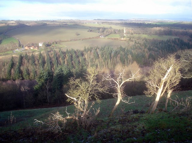
Skeleton trees above the Teme Gorge. Looking north from the edge of the gorge with the bare winter trees just catching the sunrise. The river is hidden in the trees below. On the opposite side is The Pools on the left and the impressive Victorian spire of St Giles church on the right. The gorge itself was formed when the river drained the Wigmore Glacial Lake (today, the large area of flat land to the west)


