Durham Coastal Path
![]()
![]() This walk follows a beautiful section of the Durham heritage coast from Seaham to Crimdon Park, just outside Hartlepool.
This walk follows a beautiful section of the Durham heritage coast from Seaham to Crimdon Park, just outside Hartlepool.
The path starts by Seaham harbour and heads south to Easington Colliery, passing Shippersea Bay and the lovely Hawthorn Dene on the way. This delightful reserve is run by the Durham Wildlife Trust and consists of woodland and limestone hay meadows.
The path continues south, passing Horden and Peterlee with more stunning cliff top views. Around Peterlee you will pass the wonderful Castle Eden Dene National Nature Reserve. It is the largest area of semi-natural woodland in north-east England and a major highlight on the route. The last section of the walk then takes you to the finish point at Crimdon Park just north of Hartlepool.
Please click here for more information
Durham Coastal Footpath Ordnance Survey Map  - view and print off detailed OS map
Durham Coastal Footpath Open Street Map  - view and print off detailed map
Durham Coastal Footpath OS Map  - Mobile GPS OS Map with Location tracking
Durham Coastal Footpath Open Street Map  - Mobile GPS Map with Location tracking
Pubs/Cafes
At the end of the route you'll find the Dunes Cafe at Crimdon Beach. The new cafe sells a good selection of sandwiches, cakes and drinks. It's positioned at the top of the cliff so there are some wonderful views through the wide windows or in the outdoor seating area. You can find them at postcode TS27 4BL for your sat navs. They are dog friendly.
Cycle Routes and Walking Routes Nearby
Photos
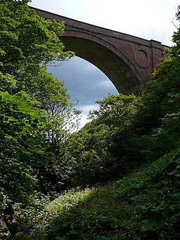
On the Coastal Path at Hawthorn Dene. The County Durham Coastal Path is forced inland under this railway viaduct, to cross the narrow gorge of Hawthorn Dene before ascending once more to recross the line and continue on its course
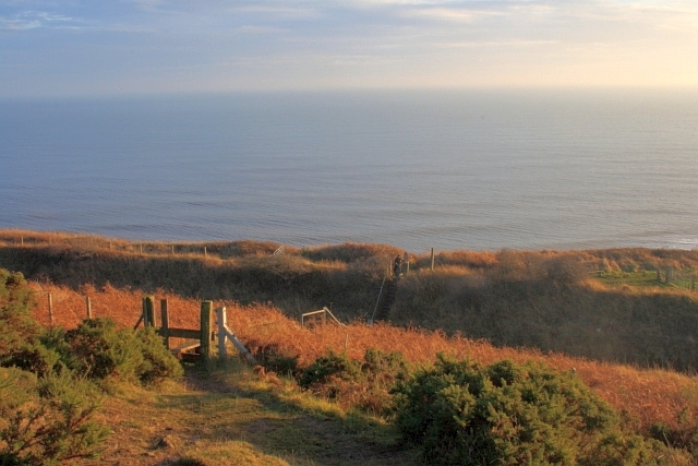
Sea cliffs north-west of Loom. Loom, named on the earliest OS maps, is the next main headland south from Shippersea. In popular use, the name has been replaced by the designation 'Aerial Flight' after the overhead cable and tipping apparatus than ran from Easington Colliery and dominated the headland. A similar bucket-conveyor, although sited further south at Blackhall Colliery features at the end of the film, 'Get Carter'As Christopher Somerville wrote for The Telegraph in 2002 the tide has turned for the once scarred East Durham coast; "I found it impossible to reconcile the beauty of this scene with what I saw here on those student jaunts, more than 30 years before - a blackened shore where a skeletal conveyor gantry vomited mine waste into a filthy, greasy sea." Mesolithic flints have been found in the area.
Elevation Profile


