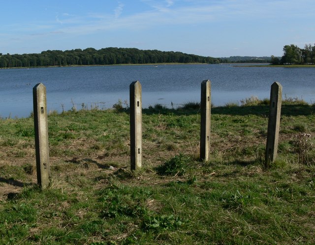
Eyebrook Reservoir
![]()
![]() Enjoy a stroll alongside this lovely reservoir near Corby. You can park at the car park at the north eastern end of the water off Main Street in Stoke Dry. The village of Stoke Dry is reputed to be the place where the Gunpowder Plot was hatched. It has an interesting medieval church dedicated to Saint Andrew.
Enjoy a stroll alongside this lovely reservoir near Corby. You can park at the car park at the north eastern end of the water off Main Street in Stoke Dry. The village of Stoke Dry is reputed to be the place where the Gunpowder Plot was hatched. It has an interesting medieval church dedicated to Saint Andrew.
You can pick up country lanes heading north along the reservoir from the car park. The area to the south is private land so please do not enter this section.
The area includes nice views of woodland and lots of wildlife. Look out for badger, fox, otter, muntjac deer, osprey, red kite, buzzards and various wildfowl on the water. Sightings include widgeon, pochard, teal and smew.
It's a beautiful area with the reservoir surrounded by rolling countryside of Leicestershire, Rutland and Northamptonshire.
If you'd like to extend your walk you could pick up the Rutland Round which passes the reservoir.
You could head to nearby Uppingham and Wardley Wood or the village of Lyddington. Here you can visit the Grade I listed Lyddington Bede House, owned by English Heritage.
You can explore the country lanes on the western side of the reservoir using the google street view link below.
Postcode
LE15 9JG - Please note: Postcode may be approximate for some rural locationsEyebrook Reservoir Ordnance Survey Map  - view and print off detailed OS map
Eyebrook Reservoir Open Street Map  - view and print off detailed map
Eyebrook Reservoir OS Map  - Mobile GPS OS Map with Location tracking
Eyebrook Reservoir Open Street Map  - Mobile GPS Map with Location tracking
Explore the Area with Google Street View 
Pubs/Cafes
If you head east from the reservoir you will soon come to the pretty little village of Lyddington. There's a very good pub here in the form of The Marquess of Exeter. It's an attractive pub with a large outdoor seating area with views of the surrounding countryside. It's the ideal spot to relax with a drink or meal in fine weather. You can find it at 52 Main Street with a postcode of LE15 9LT for your sat navs.


Pictured above left the Marquess of Exeter pub in Lyddington near the reservoir. On the right is the churchyard in the village. It's a worthy place for an easy stroll with other attractions including Lyddington Bede House, owned by English Heritage. This Grade I listed building incorporates parts of a medieval bishop's palace. The remains of the fishponds of the bishop's palace are nearby.
Further Information and Other Local Ideas
The circular Uppingham Walk visits the reservoir from the town. It also explores the local countryside and visits the neighbouring villages of Lyddington and Stoke Dry.
Just a couple of miles to the south there's Rockingham Castle near Corby. Here you'll find some interesting history and beautiful gardens to explore.
A few miles to the west there's Hallaton to explore. The village includes a particularly picturesque pond, a 13th century church and quaint thatched cottages. Hallaton is also the location for the famous annual bottle kicking contest which takes place on Easter Monday.
A few miles to the east there's some excellent mountain bike trails and walking routes to be found at Wakerley Woods and Fineshade Woods.
Just to the east of Fineshade you'll find the pretty village of King's Cliffe where you can pick up the Kings Cliffe Railway Walk. The easy trail runs along a now disused railway line to the east of the village. King's Cliffe is also a pleasant place for a stroll with a Norman church, picturesque 17th century almshouses and nice views of the Willow Brook, a tributary of the River Nene. There's also a fine old 18th century pub for refreshments afterwards. Near here there's also Blatherwycke Lake to explore. There's some lovely waterside trails with lots of birdlife to see on the water at this scenic spot.
Follow the Rutland Round east and it will take you to the noteworthy Harringworth Welland Viaduct. The Grade II listed viaduct is about a kilometre long, and was completed in 1878. It contains 82 arches and is notable as the longest masonry viaduct across a valley in Britain.
For more walking ideas in the area see the Northamptonshire Walks and the Rutland Walks pages.


