Formby Beach Walk
![]()
![]() Explore the beaches, sand dunes and woodland in this beautiful nature reserve in Formby. The area is famous for its wildlife with the Natterjack Toad and the Red Squirrel the major highlights.
Explore the beaches, sand dunes and woodland in this beautiful nature reserve in Formby. The area is famous for its wildlife with the Natterjack Toad and the Red Squirrel the major highlights.
The area is run by the National Trust so you will find a series of well laid out footpaths and waymarked trails. There is a squirrel trail through the lovely pine woodlands where you can look out for the growing population of red squirrels. There's also an asparagus trail where you can learn about Formby's asparagus heritage. This trail passes through farmland with Hebridean and Herdwick sheep.
If you'd like to continue your walking in the area then you could pick up the Sefton Coastal Footpath which runs past the site.
Postcode
L37 1LJ - Please note: Postcode may be approximate for some rural locationsPlease click here for more information
Formby Beach Ordnance Survey Map  - view and print off detailed OS map
Formby Beach Open Street Map  - view and print off detailed map
*New* - Walks and Cycle Routes Near Me Map - Waymarked Routes and Mountain Bike Trails>>
Formby Beach OS Map  - Mobile GPS OS Map with Location tracking
Formby Beach Open Street Map  - Mobile GPS Map with Location tracking
Pubs/Cafes
The Pinewoods pub is located just to the east of the woods. They do good food and have a decent selection of ales. You can find them at Wicks Green with a postcode of L37 1PR for your sat navs.
Dog Walking
The woodland and beach are ideal for dog walking so you're bound to bump into other owners on your visit. There are water bowls near the toilets and in the parking areas at Victoria Road. The Pinewoods pub mentioned above is also dog friendly.
Further Information and Other Local Ideas
Follow the Sefton Coastal footpath north and it will take you to the Ainsdale National Nature Reserve where there's more woodland and dunes to explore. You'll also pass the Royal Birkdale Golf Club before coming to the popular town of Southport.
If you head south you can visit Crosby and see the fascinating Another Place Sculptures on Crosby Beach. The Anthony Gormley piece was created in 1997, and consists of 100 cast iron figures facing towards the sea.
To the east you can pick up the Leeds and Liverpool Canal and enjoy a walk around Maghull to the Lunt Meadows Nature Reserve.
For more walking ideas in the area see the Merseyside Walks page.
Cycle Routes and Walking Routes Nearby
Photos
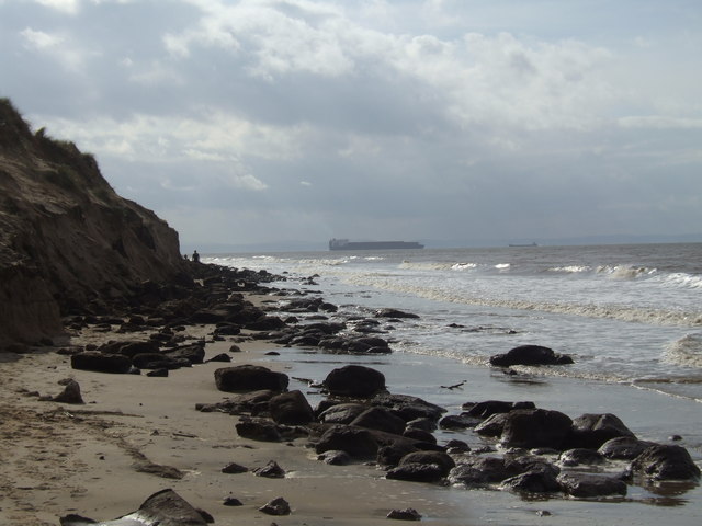
Formby beach. High spring tide lapping the dunes. The sand dunes are home to hardy plants such as marram grass, sea holly, and sand couch, which help stabilise the shifting sands. In spring and summer, dune slacks—wet areas between dunes—support rare plants like the dune pansy and marsh orchids. The open heathland areas contain gorse, heather, and creeping willow, providing shelter for insects and small mammals.
Pinewoods in Formby. Asy you make your way around the site look out and listen for the Natterjack toad. Formby is one of a few sites in England where they will breed. If you are here on a spring evening listen for the male's distinctive song known locally as the 'Bootle Organ'. At these times the males gather at the edge of shallow pools in the dune slacks and sing to attract a mate.
Pine trees on the dunes. This group of pine trees are the closest to the sea, are exposed to the wind. Formby’s pine woodlands are well known for their population of red squirrels, one of the few strongholds in England. These woodlands also support roe deer, foxes, and rabbits. Natterjack toads, a rare species in the UK, breed in the dune pools, while common frogs and newts can also be found.
Bird species in the area include sand martins nesting in the dunes, along with oystercatchers, curlews, and redshanks feeding along the shore. Woodlands attract treecreepers, goldcrests, and great spotted woodpeckers, while birds of prey such as kestrels and sparrowhawks hunt across the open spaces.
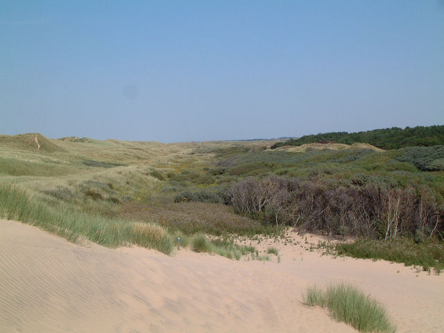
Foredunes at Formby. View northwest across the foredunes from the southern edge of the square on a scorching hot July day.
Walking to the beach. The walkers are near the edge of the dunes, which here is at the high tide mark. This photo is taken at low tide with the sea 400 metres down the beach. The track leads from the large National Trust car park to the beach.
The beach and intertidal zone provide habitat for marine life, including crabs, shrimps, and molluscs, while grey seals are sometimes spotted offshore. The combination of coastal and woodland environments makes Formby a valuable site for wildlife throughout the year.


