Greenway Bank and Knypersley Reservoir Walk
![]()
![]() Enjoy a short waterside walk around Knypersley Reservoir in this country park near Biddulph.
Enjoy a short waterside walk around Knypersley Reservoir in this country park near Biddulph.
In the park you will find quiet woodland, a lovely waterfall and the Serpentine Pool. There are also lawns and shrubberies, which are ablaze with colour from rhododendrons, azaleas and daffodils in the spring months. The park is located just south of Biddulph.
This circular walk runs around the reservoirs for a distance of about 2 miles. After your exercise head to the visitor centre where there is a nice cafe for refreshments.
The Staffordshire Moorlands Walks long distance trail runs through the park. To extend your walk you could pick it up at the southern edge of the reservoir and follow it south along the canal feeder. This will lead you to the Caldon Canal where there are more nice waterside footpaths to try. If you head north along the waymarked path it will take you to Biddulph Grange Country Park where there's some beautiful National Trust gardens.
Postcode
ST8 7QX - Please note: Postcode may be approximate for some rural locationsPlease click here for more information
Greenway Bank Country Park Ordnance Survey Map  - view and print off detailed OS map
Greenway Bank Country Park Open Street Map  - view and print off detailed map
Greenway Bank Country Park OS Map  - Mobile GPS OS Map with Location tracking
Greenway Bank Country Park Open Street Map  - Mobile GPS Map with Location tracking
Pubs/Cafes
Just to the west of the reservoir you will find the Gardeners Arms. It's a great place to go in the warmer months as it has a large outdoor seating area to relax in. You can find the pub in Brown Lees part way between Stoke and Biddulph at postcode ST8 6PH.
Dog Walking
The park and reservoir are a great place for a dog walk and you will probably see plenty of other owners on a fine day.
Cycle Routes and Walking Routes Nearby
Photos
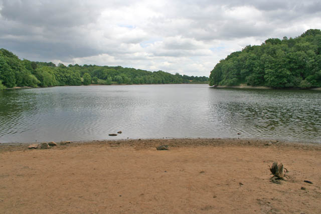
Knypersley Pool photo. The area of the Knypersley reservoir nearest the dam is known as Knypersley Pool. This commemorates the old mill pool that was lost when the reservoir was created. A watermill was demolished and rebuilt further down the valley beyond the dam and in 2006, when the water level was lowered during extensive restoration work on the reservoir, the old mill dam was exposed. Photograph taken from Greenway Bank where it goes along the top of the dam.
This is the lower, and newer, of the two reservoirs in the park. Both are owned by British Waterways and are the major feeders for the local canal system. The Serpentine Pool, was constructed in the 1780s to supply water to the Caldon canal but by the early 1820s the traffic on the canals in the area had increased so much that the water supply was insufficient. To alleviate this civil engineering giant Thomas Telford designed the adjoining Knypersley reservoir as a further feeder, together with canal engineer James Potter.
The Serpentine, Greenway Bank Country Park. This is the upper section of the reservoir system at Greenway Bank Country Park, stocked with bream, roach, carp and pike. Steep wooded banks edge the water with occasional fishing platforms round the edge. This reservoir is owned by British Waterways. Together, with the lower Knypersley reservoir, it holds a massive 930,000 cubic metres of water and provides a constant feed for the Caldon Canal and from there into the Trent & Mersey Canal.
Countryside near Greenway Bank Country Park. View from the upper car park at the country park. Knypersley Reservoir lies in the valley just beyond the trees in the centre of the photograph. The hills in the distance are almost in the next square east.
The Serpentine dam. This dam separates the Serpentine Pool to the right, from the reservoir to the left. Both stretches of water are owned by British Waterways and provide a constant feed for the Trent & Mersey canal via the Caldon canal.


