Hackness Walks
![]()
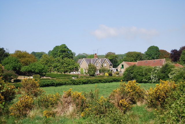
![]() This village in the North York Moors has some fine riverside trails, expansive local woodland and some excellent viewpoints to climb to.
This village in the North York Moors has some fine riverside trails, expansive local woodland and some excellent viewpoints to climb to.
This circular walk from the village takes you along the River Derwent to the nearby Wykeham Forest.
Start the walk in the village at the Hackness Grange Hotel and head south past Mill Farm to the bridge over the river. Cross here and then head west along the pleasant riverside path to Little Hill Green. You then turn south to cross the Sow Beck and head towards Mount Misery and the Wykeham Forest viewpoint at Highwood Brow. There's some fine views here over Troutsdale and Langdale to enjoy.
The route continues east past Coomb Hill before passing Wrench Green and returning to the village.
Hackness Ordnance Survey Map  - view and print off detailed OS map
Hackness Open Street Map  - view and print off detailed map
Hackness OS Map  - Mobile GPS OS Map with Location tracking
Hackness Open Street Map  - Mobile GPS Map with Location tracking
Walks near Hackness
- Wykeham Forest - This large forest in the North York Moors has miles of walking trails and a mountain bike trail.
- Tabular Hills Walk - This long distance trail takes you across the southern boundary of the North York Moors National Park
- Dalby Forest - Enjoy miles of cycling and walking trails in this large forest in the North York Moors
- Bridestones - Visit these fascinating sandstone sculptures on this splendid walk in Dalby Forest
- Helmsley Circular Walk - A lovely circular walk from Helmsley passing through Rye Dale and visiting the wonderful Rievaulx Abbey
- Broxa Forest - Visit this large forest on the North York Moors and enjoy miles of good woodland trails
- Harwood Dale Forest - Enjoy a walk through this large forest and around the pretty village of Harwood Dale on this circular route in the North York Moors.
You can start your walk from the village and then head north to reach the forest - Langdale Forest - This large forest in the North Yorks Moors has mountain bike trails and walking routes to try
- Forge Valley Woods - Follow the waterside trail through this delightful nature reserve in the North York Moors National Park
Pubs/Cafes
The Everley Country House Café is a fine spot for post walk refreshments. The main draw here is a lovely outdoor seating area with fine views over the valley. Inside there's a cosy log fire and board games to keep you entertained. You can find the cafe at a postcode of YO13 0BT for your sat navs.
Dog Walking
The river and woodland trails are ideal for dog walking.
Further Information and Other Local Ideas
Head south and you can explore Forge Valley Woods. This nature reserve has a nice boardwalk trail along the River Derwent. The woods can be reached on the circular West Ayton Walk which starts from the delightful village.
For more walking ideas in the area see the North York Moors Walks page.


